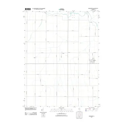
2012 Map of Hindsboro
USGS Topo · Published 2012About this map
Hindsboro anchors the eastern edge of this Illinois landscape, where the local street grid intersects with the surrounding rural road network. The village is flanked by the small settlements of Kemp and Filson to the west, connected by a series of precise county routes. This territory is defined by its sophisticated agricultural management, most visible in the Arcola Drainage Ditch Number 4 and the winding course of the Embarras River in the northeast. Natural landmarks like Henson Pond and the Scattering Fork break the geometric regularity of the section lines, while Decker Springs Rd and Deer Cr provide historical points of reference for local families and land owners tracking the evolution of Douglas County. The map provides an exceptionally clear view of the drainage patterns and small-town infrastructure at the start of the 2010s.
Find a feature on this map
52 named features on this map. Tap any name to fly to it.
Don’t see what you’re looking for? This feature index may not catch every label — zoom into the map to look around manually.
Map Details
Editions of this 2012 Hindsboro Map
This is the sole edition of this map. No revisions or reprints were ever made.
Other maps of this area

1935 · Arcola
USGS Topo · 1:48,000

1936 · Oakland
USGS Topo · 1:48,000

1940 · Arcola
USGS Topo · 1:62,500

1942 · Oakland
USGS Topo · 1:62,500

1950 · Tuscola
USGS Topo · 1:62,500

1956 · Villa Grove
USGS Topo · 1:62,500

1958 · Decatur
USGS Topo · 1:250,000

1961 · Decatur
USGS Topo · 1:250,000
1975 · Tuscola SE
USGS Topo · 1:24,000
1982 · Villa Grove
USGS Topo · 1:24,000