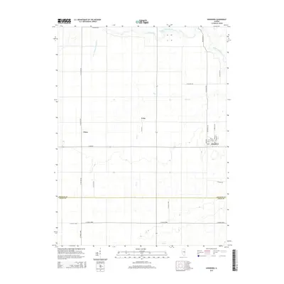
2015 Map of Hindsboro
USGS Topo · Published 2015About this map
Hindsboro anchors the eastern edge of this East Central Illinois landscape, revealing a traditional Midwestern grid of streets including Indiana St and Missouri St. The surrounding countryside is defined by the transition between the agricultural uplands and the riparian systems of the Embarras River, which winds across the northern section of the map. Smaller watercourses like Scattering Fork and Deer Cr navigate the terrain alongside localized features such as Henson Pond.
Find a feature on this map
33 named features on this map. Tap any name to fly to it.
Don’t see what you’re looking for? This feature index may not catch every label — zoom into the map to look around manually.
Map Details
Editions of this 2015 Hindsboro Map
This is the sole edition of this map. No revisions or reprints were ever made.
Other maps of this area

1935 · Arcola
USGS Topo · 1:48,000

1936 · Oakland
USGS Topo · 1:48,000

1940 · Arcola
USGS Topo · 1:62,500

1942 · Oakland
USGS Topo · 1:62,500

1950 · Tuscola
USGS Topo · 1:62,500

1956 · Villa Grove
USGS Topo · 1:62,500

1958 · Decatur
USGS Topo · 1:250,000

1961 · Decatur
USGS Topo · 1:250,000
1975 · Tuscola SE
USGS Topo · 1:24,000
1982 · Villa Grove
USGS Topo · 1:24,000