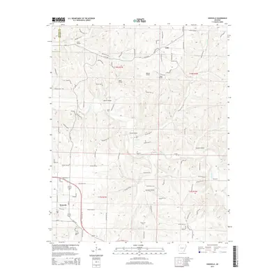
2014 Map of Hindsville
USGS Topo · Published 2014About this map
Hindsville stands as a focal point in this 2014 survey of Madison County, situated at the junction of the Clifty Hwy and local routes like Whitener Br. The terrain is defined by a dense network of drainage systems, most notably War Eagle Creek and its many tributaries including Clear Creek and Glade Creek. These waterways have carved numerous named valleys such as Walnut Hollow, Poyner Hollow, and Houston Hollow, creating a landscape of prominent ridges like Keefer Mountain and Tater Hill.
Find a feature on this map
85 named features on this map. Tap any name to fly to it.
Don’t see what you’re looking for? This feature index may not catch every label — zoom into the map to look around manually.
Map Details
Editions of this 2014 Hindsville Map
This is the sole edition of this map. No revisions or reprints were ever made.
Other maps of this area

1900 · Eureka Springs
USGS Topo · 1:125,000

1901 · Eureka Springs
USGS Topo · 1:125,000

1945 · Harrison
USGS Topo · 1:250,000

1949 · Harrison
USGS Topo · 1:250,000

1954 · Harrison
USGS Topo · 1:250,000

1957 · Mundell
USGS Topo · 1:24,000

1957 · War Eagle
USGS Topo · 1:24,000
1958 · Goshen
USGS Topo · 1:24,000
1958 · Spring Valley
USGS Topo · 1:24,000

1958 · Hindsville
USGS Topo · 1:24,000