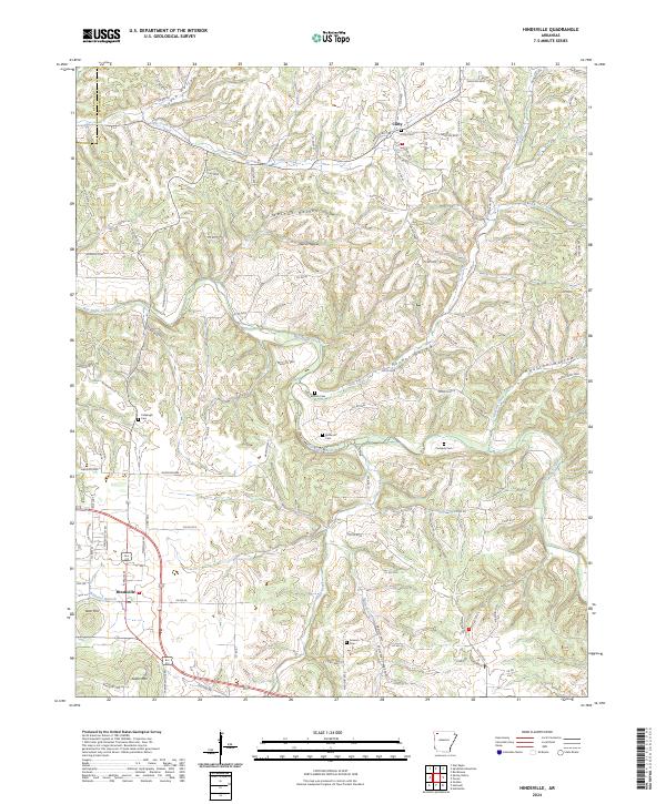
2024 Map of Hindsville
USGS Topo · Published 2024About this map
Hindsville and Clifty serve as the primary anchors of this Madison County landscape, where the meandering course of War Eagle Creek and its many tributaries carve a complex network of ridges and hollows. The area's settlement history is etched into the terrain through numerous family and community burial grounds, including the Clifty Cem, Bohannan Cem, and Colbaugh Cem. These landmarks, alongside prominent elevations like Keefer Mtn and Tater Hill, provide a detailed look at the rural geography of Northwest Arkansas.
Find a feature on this map
106 named features on this map. Tap any name to fly to it.
Don’t see what you’re looking for? This feature index may not catch every label — zoom into the map to look around manually.
Map Details
Editions of this 2024 Hindsville Map
This is the sole edition of this map. No revisions or reprints were ever made.
Other maps of this area

1900 · Eureka Springs
USGS Topo · 1:125,000

1901 · Eureka Springs
USGS Topo · 1:125,000

1945 · Harrison
USGS Topo · 1:250,000

1949 · Harrison
USGS Topo · 1:250,000

1954 · Harrison
USGS Topo · 1:250,000

1957 · Mundell
USGS Topo · 1:24,000

1957 · War Eagle
USGS Topo · 1:24,000
1958 · Goshen
USGS Topo · 1:24,000
1958 · Spring Valley
USGS Topo · 1:24,000

1958 · Hindsville
USGS Topo · 1:24,000