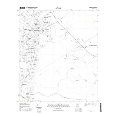
2014 Map of Hinesville
USGS Topo · Published 2014About this map
Fort Stewart dominates the northern landscape of this Liberty County region, creating a distinct boundary between military grounds and the expanding residential outskirts of Hinesville. The map captures a moment of significant suburbanization, as dozens of named neighborhoods like Harrison Heights, Garden Acres, and Cherokee Village fill the spaces between historic transit corridors. The infrastructure is anchored by the E Oglethorpe Hwy and W Oglethorpe Hwy, which serve as the primary commercial and commuter arteries for the area.
Find a feature on this map
170 named features on this map. Tap any name to fly to it.
Don’t see what you’re looking for? This feature index may not catch every label — zoom into the map to look around manually.
Map Details
Editions of this 2014 Hinesville Map
This is the sole edition of this map. No revisions or reprints were ever made.
Other maps of this area

1918 · Hinesville
USGS Topo · 1:62,500

1920 · Sapelo River
USGS Topo · 1:62,500

1920 · Limerick
USGS Topo · 1:62,500

1943 · Ludowici
USGS Topo · 1:62,500

1943 · Sapelo River
USGS Topo · 1:62,500

1944 · Hinesville
USGS Topo · 1:62,500

1944 · Limerick
USGS Topo · 1:62,500

1945 · Sapelo River
USGS Topo · 1:62,500

1946 · Brunswick
USGS Topo · 1:250,000

1948 · Brunswick
USGS Topo · 1:250,000