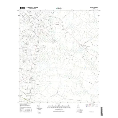
2017 Map of Hinesville
USGS Topo · Published 2017About this map
Fort Stewart borders the northern reaches of Hinesville in this 2017 survey of coastal Georgia's Liberty County. The landscape is defined by its extensive wetlands and named swamps, such as Goshen Swamp and Bull Town Swamp, which separate the primary residential and commercial centers from more isolated rural reaches. The map details the expansion of Hinesville alongside established smaller communities like Flemington, Allenhurst, and Walthourville. For genealogists and local historians, several burial sites are recorded, including Cypress Slash Cem and Bacon Cem. The survey highlights a complex network of named roads like Old Savannah Rd and General Stewart Way, reflecting the intersection of modern military infrastructure with centuries-old travel routes through the Georgia lowcountry.
Find a feature on this map
188 named features on this map. Tap any name to fly to it.
Don’t see what you’re looking for? This feature index may not catch every label — zoom into the map to look around manually.
Map Details
Editions of this 2017 Hinesville Map
This is the sole edition of this map. No revisions or reprints were ever made.
Other maps of this area

1918 · Hinesville
USGS Topo · 1:62,500

1920 · Sapelo River
USGS Topo · 1:62,500

1920 · Limerick
USGS Topo · 1:62,500

1943 · Ludowici
USGS Topo · 1:62,500

1943 · Sapelo River
USGS Topo · 1:62,500

1944 · Hinesville
USGS Topo · 1:62,500

1944 · Limerick
USGS Topo · 1:62,500

1945 · Sapelo River
USGS Topo · 1:62,500

1946 · Brunswick
USGS Topo · 1:250,000

1948 · Brunswick
USGS Topo · 1:250,000