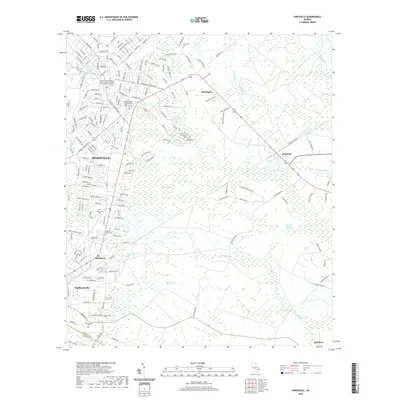
2020 Map of Hinesville
USGS Topo · Published 2020About this map
Hinesville and its surrounding communities in Liberty County appear as a complex network of residential streets and vast coastal wetlands. The landscape is defined by extensive drainage systems like Bull Town Swamp and Captain Fleming Swamp, which dictate the placement of settlements and transport corridors. To the north, the Central Texas College - Fort Stewart and Hunter Army Airfield Campus marks the military presence that has long shaped this region's economy and growth. Local history is anchored by numerous burial grounds including Flemington Cem and Cypress Slash Cem, while the Liberty County Justice Center stands as a focal point for the county seat. The drainage patterns of Riceboro Cr and Peacock Cr reflect the low-lying geography that transitions from the urban center of Hinesville to the smaller outliers of Allenhurst and Walthourville.
Find a feature on this map
193 named features on this map. Tap any name to fly to it.
Don’t see what you’re looking for? This feature index may not catch every label — zoom into the map to look around manually.
Map Details
Editions of this 2020 Hinesville Map
This is the sole edition of this map. No revisions or reprints were ever made.
Other maps of this area

1918 · Hinesville
USGS Topo · 1:62,500

1920 · Sapelo River
USGS Topo · 1:62,500

1920 · Limerick
USGS Topo · 1:62,500

1943 · Ludowici
USGS Topo · 1:62,500

1943 · Sapelo River
USGS Topo · 1:62,500

1944 · Hinesville
USGS Topo · 1:62,500

1944 · Limerick
USGS Topo · 1:62,500

1945 · Sapelo River
USGS Topo · 1:62,500

1946 · Brunswick
USGS Topo · 1:250,000

1948 · Brunswick
USGS Topo · 1:250,000