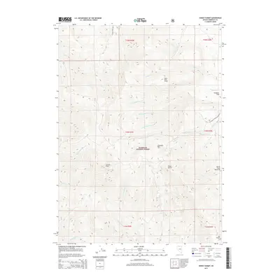
2015 Map of Hinkey Summit
USGS Topo · Published 2015About this map
Hinkey Summit serves as the high-elevation focal point of this Nevada survey, marking the divide between the Santa Rosa Range and the Martin Creek Mountains. Located within the Humboldt National Forest, the area is defined by a dense network of watercourses branching from high peaks like Granite Peak and Chocolate Mtn. The drainages of Lye Cr, Road Cr, and multiple forks of Dutch John Cr illustrate the complex watershed management within the national forest system. To the east, Bradshaw Field offers a rare break in the steep elevation, while the south reveals the deep descent into Box Canyon. Access through this high-altitude landscape is concentrated along the Natl Forest Develop Road 084 Rd, which connects the various mountain passes and creek basins used for range management and recreation.
Find a feature on this map
34 named features on this map. Tap any name to fly to it.
Don’t see what you’re looking for? This feature index may not catch every label — zoom into the map to look around manually.
Map Details
Editions of this 2015 Hinkey Summit Map
This is the sole edition of this map. No revisions or reprints were ever made.
Other maps of this area

1882 · Paradise
USGS Topo · 1:250,000

1893 · Paradise
USGS Topo · 1:250,000

1955 · McDermitt
USGS Topo · 1:250,000

1959 · McDermitt
USGS Topo · 1:250,000

1959 · McDermitt
USGS Topo · 1:62,500

1959 · Hinkey Summit
USGS Topo · 1:62,500

1980 · Black Ridge
USGS Topo · 1:24,000

1980 · Spring City
USGS Topo · 1:24,000
1980 · Holloway Meadows
USGS Topo · 1:24,000

1985 · Quinn River Valley
USGS Topo · 1:100,000