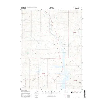
2016 Map of Hinman Reservoir
USGS Topo · Published 2016About this map
Wolford Mountain Reservoir dominates the drainage basin of Muddy Cr in this northern Colorado landscape, serving as a focal point for water management in the region. The area is defined by its complex irrigation and water storage network, which includes the namesake Hinman Reservoir, the smaller Heini Reservoir, and Antelope Reservoir. These man-made features work in tandem with natural watercourses like Antelope Cr and Carter Cr to sustain the high-elevation ranching and agricultural lands of Grand County.
Find a feature on this map
29 named features on this map. Tap any name to fly to it.
Don’t see what you’re looking for? This feature index may not catch every label — zoom into the map to look around manually.
Map Details
Editions of this 2016 Hinman Reservoir Map
This is the sole edition of this map. No revisions or reprints were ever made.
Other maps of this area

1954 · Craig
USGS Topo · 1:250,000

1956 · Lake Agnes
USGS Topo · 1:24,000

1956 · Kremmling
USGS Topo · 1:62,500

1956 · Whiteley Peak
USGS Topo · 1:24,000

1956 · Hyannis Peak
USGS Topo · 1:24,000

1956 · Gore Pass
USGS Topo · 1:62,500

1956 · Hyannis Peak
USGS Topo · 1:62,500

1956 · Rabbit Ears Peak
USGS Topo · 1:62,500

1957 · Craig
USGS Topo · 1:250,000

1958 · Craig
USGS Topo · 1:250,000