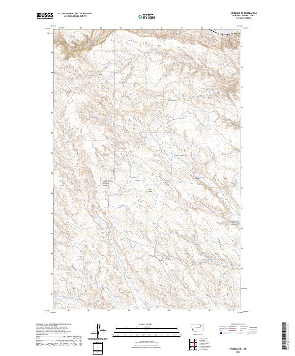
2024 Map of Hinsdale SE
USGS Topo · Published 2024About this map
Ruby Reservoir sits within a landscape defined by an intricate drainage system in Valley County. The terrain is characterized by numerous coulees and creeks that have carved distinct patterns across the plains. Tributaries such as North Fork Antelope Creek and South Fork Antelope Creek move through the southern sections, while the north is marked by Ash Coulee and Buffalo Coulee. This drainage network suggests a landscape shaped by seasonal water movement and the erosion typical of the Montana plains. Transportation in the area is largely facilitated by primitive routes and local thoroughfares, including Valley View Trl and S Bench Rd, which navigate the rises between the coulees. The map's detail provides a clear view of how topographic variations dictate the placement of roads like Porteen Rd and Ridge Rd along the high ground.
Find a feature on this map
18 named features on this map. Tap any name to fly to it.
Don’t see what you’re looking for? This feature index may not catch every label — zoom into the map to look around manually.
Map Details
Editions of this 2024 Hinsdale SE Map
This is the sole edition of this map. No revisions or reprints were ever made.
Other maps of this area

1906 · Hinsdale Special Map
USGS Topo · 1:62,500

1943 · Glasgow
USGS Topo · 1:125,000

1954 · Glasgow
USGS Topo · 1:250,000

1957 · Glasgow
USGS Topo · 1:250,000

1958 · Glasgow
USGS Topo · 1:250,000

1958 · Miller Coulee
USGS Topo · 1:62,500
1958 · Billick Coulee
USGS Topo · 1:24,000

1969 · Vandalia
USGS Topo · 1:24,000

1969 · Ellsworth Coulee
USGS Topo · 1:24,000
1984 · Hardpan Coulee
USGS Topo · 1:24,000