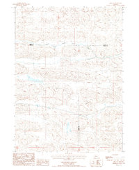
1987 Map of Hire SW
USGS Topo · Published 1987About this map
South Branch Middle Loup River meanders across the northern portion of this Nebraska Sandhills terrain, defining the local hydrology and landscape character during the mid-1980s. This survey, compiled from aerial photography, captures a sparsely settled region where the boundaries of Cherry, Grant, and Hooker counties converge. The topography is dominated by stabilized sand dunes and depressions, reflecting the distinct environmental patterns of the central part of the state. While largely devoid of named settlements or heavy infrastructure, the map serves as a precise record of the river's path and the intersection of these three major Nebraska counties before further modern development changed the local land use.
Find a feature on this map
4 named features on this map. Tap any name to fly to it.
Don’t see what you’re looking for? This feature index may not catch every label — zoom into the map to look around manually.
Map Details
Editions of this 1987 Hire SW Map
This is the sole edition of this map. No revisions or reprints were ever made.
Other maps of this area

1948 · Carr Lake
USGS Topo · 1:62,500

1948 · Whitman
USGS Topo · 1:62,500

1948 · Spring Valley
USGS Topo · 1:62,500

1950 · Spring Valley
USGS Topo · 1:62,500

1950 · Whitman
USGS Topo · 1:62,500

1950 · Carr Lake
USGS Topo · 1:62,500

1950 · Hire
USGS Topo · 1:62,500

1954 · North Platte
USGS Topo · 1:250,000

1956 · North Platte
USGS Topo · 1:250,000

1957 · North Platte
USGS Topo · 1:250,000