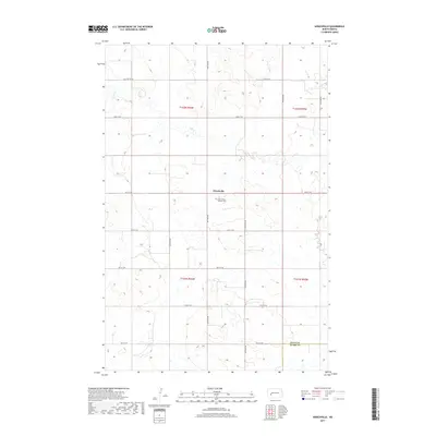
2017 Map of Hirschville
USGS Topo · Published 2017About this map
Hirschville serves as the central focal point of this rural North Dakota landscape, situated along the county line where Dunn Co meets Stark Co. This modern survey documents the gridded road network and rolling terrain that define the region, anchored by the Saint Phillips Catholic Cem just south of the settlement. The hydrology is dominated by the winding path of Deep Cr, which cuts through the northwestern portion of the map. The landscape reflects the enduring agricultural and pastoral layout of the Great Plains, with section lines clearly marked by roads like 24th St SW and 98th Ave SW. This map is a primary resource for tracing the geography of this quiet community and its surrounding townships, showing the precise location of local landmarks and boundary divisions at the start of the 21st century.
Find a feature on this map
21 named features on this map. Tap any name to fly to it.
Don’t see what you’re looking for? This feature index may not catch every label — zoom into the map to look around manually.
Map Details
Editions of this 2017 Hirschville Map
This is the sole edition of this map. No revisions or reprints were ever made.
Other maps of this area

1953 · Dickinson
USGS Topo · 1:250,000

1953 · Watford City
USGS Topo · 1:250,000

1957 · Dickinson
USGS Topo · 1:250,000

1957 · Watford City
USGS Topo · 1:250,000

1962 · Davis Buttes
USGS Topo · 1:24,000

1967 · Watford City
USGS Topo · 1:250,000

1973 · Boyle
USGS Topo · 1:24,000

1973 · Taylor
USGS Topo · 1:24,000

1973 · Marshall SW
USGS Topo · 1:24,000

1973 · Ziner Butte
USGS Topo · 1:24,000