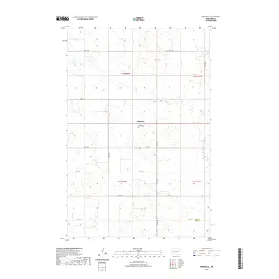
2020 Map of Hirschville
USGS Topo · Published 2020About this map
Hirschville sits at the center of this rural Dunn County landscape, where the prairie is defined by the winding course of Deep Cr. The settlement's social and historical heart is marked by the Saint Phillips Catholic Cem, a key landmark for genealogists tracing the heritage of this plains community. The map details a rigid section-line road network, with routes like 24th St SW and 98th Ave SW providing access to the vast agricultural tracts that dominate the topography. Near the southern edge of the survey, the boundary between Dunn Co and Stark Co is clearly delineated, illustrating the administrative divisions of this region during the early 21st century. The drainage patterns of Deep Cr reveal the subtle natural contours that dictated early settlement patterns and land use in this part of North Dakota.
Find a feature on this map
22 named features on this map. Tap any name to fly to it.
Don’t see what you’re looking for? This feature index may not catch every label — zoom into the map to look around manually.
Map Details
Editions of this 2020 Hirschville Map
This is the sole edition of this map. No revisions or reprints were ever made.
Other maps of this area

1953 · Dickinson
USGS Topo · 1:250,000

1953 · Watford City
USGS Topo · 1:250,000

1957 · Dickinson
USGS Topo · 1:250,000

1957 · Watford City
USGS Topo · 1:250,000

1962 · Davis Buttes
USGS Topo · 1:24,000

1967 · Watford City
USGS Topo · 1:250,000

1973 · Boyle
USGS Topo · 1:24,000

1973 · Taylor
USGS Topo · 1:24,000

1973 · Marshall SW
USGS Topo · 1:24,000

1973 · Ziner Butte
USGS Topo · 1:24,000