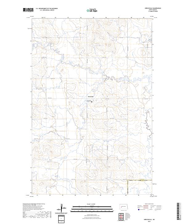
2024 Map of Hirschville
USGS Topo · Published 2024About this map
Hirschville sits at the heart of this rural North Dakota landscape, situated at the junction of 98th Ave SW and 24th St SW. This section of the Great Plains is defined by the winding course of Deep Creek, which meanders through the northern half of the survey area, cutting through the high prairie plateaus. A significant local landmark is the Saint Phillips Catholic Cem, located just south of the main settlement. The map documents the precisely surveyed township and range grid characteristic of the region, including the border where Dunn Co meets Stark Co in the south. The road network follows these section lines strictly, creating a geometric pattern of travel through the rolling terrain of the Missouri Plateau.
Find a feature on this map
22 named features on this map. Tap any name to fly to it.
Don’t see what you’re looking for? This feature index may not catch every label — zoom into the map to look around manually.
Map Details
Editions of this 2024 Hirschville Map
This is the sole edition of this map. No revisions or reprints were ever made.
Other maps of this area

1953 · Dickinson
USGS Topo · 1:250,000

1953 · Watford City
USGS Topo · 1:250,000

1957 · Dickinson
USGS Topo · 1:250,000

1957 · Watford City
USGS Topo · 1:250,000

1962 · Davis Buttes
USGS Topo · 1:24,000

1967 · Watford City
USGS Topo · 1:250,000

1973 · Boyle
USGS Topo · 1:24,000

1973 · Taylor
USGS Topo · 1:24,000

1973 · Marshall SW
USGS Topo · 1:24,000

1973 · Ziner Butte
USGS Topo · 1:24,000