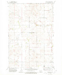
1973 Map of Hirschville
USGS Topo · Published 1977About this map
The small settlement of Hirschville serves as the focal point of this 1970s survey, situated along the county line between Dunn Co and Stark Co in western North Dakota. The landscape is defined by the winding course of Deep Creek and a network of subterranean resources, indicated by the presence of a long Pipeline, multiple instances of a Well, and a notable Flowing Well in the southwest. Social and agricultural life is centered on landmarks such as St Phillips Ch, which anchors the small community, and scattered infrastructure like the Storage Bin found near the creek. The terrain is characterized by numerous small coulees and draws, illustrating the rural character of the region before further modern development.
Find a feature on this map
9 named features on this map. Tap any name to fly to it.
Don’t see what you’re looking for? This feature index may not catch every label — zoom into the map to look around manually.
Map Details
Editions of this 1973 Hirschville Map
This is the sole edition of this map. No revisions or reprints were ever made.
Other maps of this area

1953 · Dickinson
USGS Topo · 1:250,000

1953 · Watford City
USGS Topo · 1:250,000

1957 · Dickinson
USGS Topo · 1:250,000

1957 · Watford City
USGS Topo · 1:250,000

1962 · Davis Buttes
USGS Topo · 1:24,000

1967 · Watford City
USGS Topo · 1:250,000

1973 · Boyle
USGS Topo · 1:24,000

1973 · Taylor
USGS Topo · 1:24,000

1973 · Marshall SW
USGS Topo · 1:24,000

1973 · Ziner Butte
USGS Topo · 1:24,000