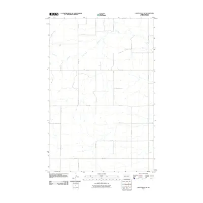
2011 Map of Hirschville SW
USGS Topo · Published 2011About this map
Deep Creek meanders through the northern reaches of this rural landscape in Dunn County, providing a primary drainage feature for the surrounding prairie. The topography is defined by a strict section-line road grid that segments the terrain into large agricultural blocks, typical of the Great Plains' settlement pattern. Significant north-south corridors like 106th Ave SW and 101st Ave SW anchor the transportation network, while east-west routes such as 21st St SW and 28th St SW delineate the boundaries of the quadrangle. This 2011 survey captures the spatial organization of a region focused on large-scale land management and livestock grazing, where human footprints are largely confined to the straight-edged geometry of the county road system and isolated farmstead sites.
Find a feature on this map
14 named features on this map. Tap any name to fly to it.
Don’t see what you’re looking for? This feature index may not catch every label — zoom into the map to look around manually.
Map Details
Editions of this 2011 Hirschville SW Map
This is the sole edition of this map. No revisions or reprints were ever made.
Other maps of this area

1953 · Dickinson
USGS Topo · 1:250,000

1953 · Watford City
USGS Topo · 1:250,000

1957 · Dickinson
USGS Topo · 1:250,000

1957 · Watford City
USGS Topo · 1:250,000

1959 · Dickinson North
USGS Topo · 1:24,000

1962 · Davis Buttes
USGS Topo · 1:24,000

1967 · Watford City
USGS Topo · 1:250,000

1973 · Boyle
USGS Topo · 1:24,000

1973 · Manning SE
USGS Topo · 1:24,000

1973 · Ziner Butte
USGS Topo · 1:24,000