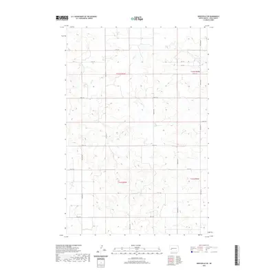
2020 Map of Hirschville SW
USGS Topo · Published 2020About this map
Deep Cr winds through the northern portion of this Dunn County landscape, providing a primary drainage feature for the sectioned prairie. This 2020 survey illustrates the rigid Public Land Survey System layout, defined by township boundaries such as T142n R95w and T141n R95w. The map reveals a strictly organized rural infrastructure where local movement is dictated by a grid of section-line roads, including 21st St SW and 28th St SW. The terrain is characterized by subtle drainage patterns and high points that reach above 2,500 feet, reflecting the agricultural and ranching heritage of western North Dakota. This modern topographic record captures the enduring spatial organization of the Great Plains, where the original land divisions of the 19th century continue to shape the contemporary road network and land use.
Find a feature on this map
15 named features on this map. Tap any name to fly to it.
Don’t see what you’re looking for? This feature index may not catch every label — zoom into the map to look around manually.
Map Details
Editions of this 2020 Hirschville SW Map
This is the sole edition of this map. No revisions or reprints were ever made.
Other maps of this area

1953 · Dickinson
USGS Topo · 1:250,000

1953 · Watford City
USGS Topo · 1:250,000

1957 · Dickinson
USGS Topo · 1:250,000

1957 · Watford City
USGS Topo · 1:250,000

1959 · Dickinson North
USGS Topo · 1:24,000

1962 · Davis Buttes
USGS Topo · 1:24,000

1967 · Watford City
USGS Topo · 1:250,000

1973 · Boyle
USGS Topo · 1:24,000

1973 · Manning SE
USGS Topo · 1:24,000

1973 · Ziner Butte
USGS Topo · 1:24,000