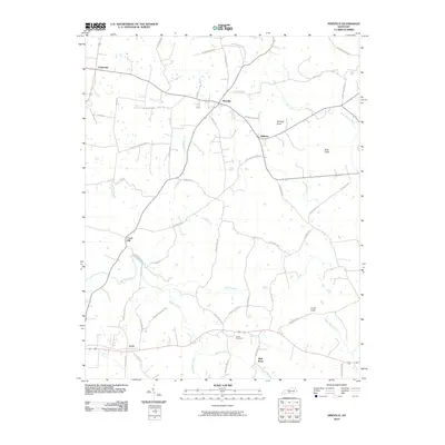
2010 Map of Hiseville
USGS Topo · Published 2010About this map
Hiseville serves as a central hub in this Barren County landscape, where a dense network of local roads such as New Cut Rd and Coral Hill-Halfway Rd connects small rural communities. The terrain is defined by prominent elevations like Winlock Knob and Loves Knob, which rise above the winding paths of Beaver Creek and Barren Fork. For genealogists and local historians, the map preserves the exact locations of family-named thoroughfares and the Arnett Cemetery, positioned near the southern settlements of Lecta and Slick Rock. The presence of several mill roads, including French Mill Rd and Mayfield Mill Rd, points to a history of water-powered industry along Duff Branch and its tributaries, illustrating how the regional economy was traditionally tied to these small waterways.
Find a feature on this map
55 named features on this map. Tap any name to fly to it.
Don’t see what you’re looking for? This feature index may not catch every label — zoom into the map to look around manually.
Map Details
Editions of this 2010 Hiseville Map
This is the sole edition of this map. No revisions or reprints were ever made.
Other maps of this area

1935 · Horse Cave
USGS Topo · 1:48,000

1938 · Horse Cave
USGS Topo · 1:62,500

1953 · Sulphur Well
USGS Topo · 1:24,000

1953 · Temple Hill
USGS Topo · 1:24,000

1953 · Glasgow South
USGS Topo · 1:24,000

1953 · Summer Shade
USGS Topo · 1:24,000

1953 · Center
USGS Topo · 1:24,000

1954 · Park
USGS Topo · 1:24,000

1954 · Horse Cave
USGS Topo · 1:24,000
1954 · Glasgow North
USGS Topo · 1:24,000