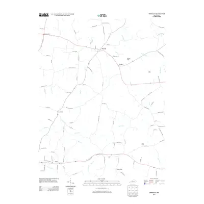
2013 Map of Hiseville
USGS Topo · Published 2013About this map
Hiseville and Griderville anchor a landscape defined by traditional rural settlements and the winding waterways of Barren County. This 2013 survey reveals a pattern of ridge-top roads and creek-bottom drainage typical of the region, where the Barren Fork and Beaver Cr navigate the undulating terrain. The area is punctuated by prominent high points such as Winlock Knob and Buck Knob, which have long served as local landmarks. Cultural features include several small crossroads communities like Lecta, Coral Hill, and Slick Rock, alongside the Arnett Cem. This map is particularly useful for those tracing the family-named road networks that lace the county, such as Jack Turner Rd and Ike Morrison Rd, which provide evidence of the area's long-standing agricultural and residential partitions.
Find a feature on this map
90 named features on this map. Tap any name to fly to it.
Don’t see what you’re looking for? This feature index may not catch every label — zoom into the map to look around manually.
Map Details
Editions of this 2013 Hiseville Map
This is the sole edition of this map. No revisions or reprints were ever made.
Other maps of this area

1935 · Horse Cave
USGS Topo · 1:48,000

1938 · Horse Cave
USGS Topo · 1:62,500

1953 · Sulphur Well
USGS Topo · 1:24,000

1953 · Temple Hill
USGS Topo · 1:24,000

1953 · Glasgow South
USGS Topo · 1:24,000

1953 · Summer Shade
USGS Topo · 1:24,000

1953 · Center
USGS Topo · 1:24,000

1954 · Park
USGS Topo · 1:24,000

1954 · Horse Cave
USGS Topo · 1:24,000
1954 · Glasgow North
USGS Topo · 1:24,000