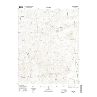
2016 Map of Hiseville
USGS Topo · Published 2016About this map
Hiseville serves as a central hub for this rural stretch of Barren County, where local roads radiate out to smaller settlements like Griderville, Lecta, and Slick Rock. The landscape is defined by the winding paths of several watercourses, most notably the Barren Fork and Beaver Creek, which shape the rolling terrain of south-central Kentucky. For genealogists, the Arnett Cem near the junction of Slick Rock and Wildcat Rd provides a specific point of historical reference in an area otherwise dominated by family farms and local landmarks like Winlock Knob and Buck Knob. The map traces the county boundary between Metcalfe and Barren counties, highlighting the intricate network of secondary roads such as Peterson Morrison Rd and Goodnight Hiseville Rd that have connected these agricultural communities for generations.
Find a feature on this map
82 named features on this map. Tap any name to fly to it.
Don’t see what you’re looking for? This feature index may not catch every label — zoom into the map to look around manually.
Map Details
Editions of this 2016 Hiseville Map
This is the sole edition of this map. No revisions or reprints were ever made.
Other maps of this area

1935 · Horse Cave
USGS Topo · 1:48,000

1938 · Horse Cave
USGS Topo · 1:62,500

1953 · Sulphur Well
USGS Topo · 1:24,000

1953 · Temple Hill
USGS Topo · 1:24,000

1953 · Glasgow South
USGS Topo · 1:24,000

1953 · Summer Shade
USGS Topo · 1:24,000

1953 · Center
USGS Topo · 1:24,000

1954 · Park
USGS Topo · 1:24,000

1954 · Horse Cave
USGS Topo · 1:24,000
1954 · Glasgow North
USGS Topo · 1:24,000