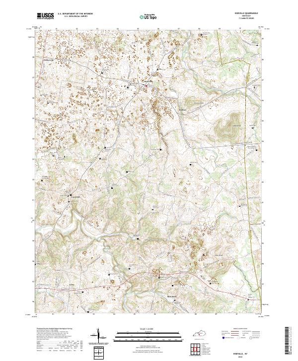
2022 Map of Hiseville
USGS Topo · Published 2022About this map
Hiseville serves as the central hub of this agricultural region in Barren County, situated along the boundary with Metcalfe County. The landscape is characterized by a dense network of family cemeteries and rural burial grounds, including the Walton Family Cem, Everett Cem Number 3, and the Jessie Crenshaw - Blue Spring Cem, reflecting generations of local land ownership. To the south, the terrain becomes more defined by natural landmarks like Winlock Knob and Loves Knob, which rise above the drainage basins of Beaver Cr and Barren Fork. Small communities and crossroads such as Lecta, Coral Hill, and Griderville anchor the surrounding farmland, connected by a web of local routes like Sulphur Well Knob Lick Rd. This 2022 survey documents a rural Kentucky landscape where modern life continues to trace the footprints of its early settlers.
Find a feature on this map
131 named features on this map. Tap any name to fly to it.
Don’t see what you’re looking for? This feature index may not catch every label — zoom into the map to look around manually.
Map Details
Editions of this 2022 Hiseville Map
This is the sole edition of this map. No revisions or reprints were ever made.
Other maps of this area

1935 · Horse Cave
USGS Topo · 1:48,000

1938 · Horse Cave
USGS Topo · 1:62,500

1953 · Sulphur Well
USGS Topo · 1:24,000

1953 · Temple Hill
USGS Topo · 1:24,000

1953 · Glasgow South
USGS Topo · 1:24,000

1953 · Summer Shade
USGS Topo · 1:24,000

1953 · Center
USGS Topo · 1:24,000

1954 · Park
USGS Topo · 1:24,000

1954 · Horse Cave
USGS Topo · 1:24,000
1954 · Glasgow North
USGS Topo · 1:24,000