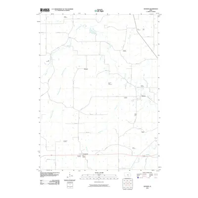
2010 Map of Hiteman
USGS Topo · Published 2010About this map
Georgetown and Hiteman anchor this area of Monroe County, reflecting the deep coal mining and agricultural heritage of southern Iowa. The landscape is dotted with several family and community burial grounds, such as Bell Cemetery and Abegglen Cemetery, which serve as vital markers for genealogical research. The legacy of the coal industry is evident in the presence of the Smoky Hollow Mine and Hiteman Mine Number 10, indicating the intensive extraction that once defined the local economy. Waterways like Cedar Creek and Bee Branch wind through the sectioned grid of rural roads, including Co Rd H35. Small settlements like Rexfield, Ward, and Halpin are situated along these transit corridors, while the Saint Patricks Cemetery and Georgetown Rest Area provide focal points along the southern highway. This map provides a clear record of the intersection between industrial mining sites and long-established rural town sites.
Find a feature on this map
59 named features on this map. Tap any name to fly to it.
Don’t see what you’re looking for? This feature index may not catch every label — zoom into the map to look around manually.
Map Details
Editions of this 2010 Hiteman Map
This is the sole edition of this map. No revisions or reprints were ever made.
Other maps of this area

1924 · Melcher
USGS Topo · 1:62,500

1929 · Albia
USGS Topo · 1:62,500

1935 · Russell
USGS Topo · 1:62,500

1938 · Russell
USGS Topo · 1:62,500

1939 · Mystic
USGS Topo · 1:62,500

1942 · Mystic
USGS Topo · 1:62,500

1954 · Centerville
USGS Topo · 1:250,000

1954 · Des Moines
USGS Topo · 1:250,000

1956 · Des Moines
USGS Topo · 1:250,000

1957 · Des Moines
USGS Topo · 1:250,000