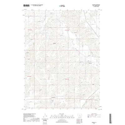
2018 Map of Hiteman
USGS Topo · Published 2018About this map
Georgetown and Hiteman anchor this section of Monroe County, showing a landscape defined by small rural settlements and a dense network of local cemeteries. The terrain is deeply dissected by the drainages of Cedar Cr and Whites Cr, creating a topography where roads like Co Rd H32 and Co Rd H35 must wind through the valleys and ridges. For genealogists, the map is particularly valuable for its density of burial sites, including Saint Patricks Cem, Abegglen Cem, and Rowley Cem. The concentration of these smaller communities, such as Consol, Rexfield, and Ward, suggests a historical reliance on the localized resources of the Iowa countryside. The transition between these small hubs is marked by a grid of secondary roads and trails, illustrating the persistent land divisions of the Public Land Survey System even in this more modern era.
Find a feature on this map
48 named features on this map. Tap any name to fly to it.
Don’t see what you’re looking for? This feature index may not catch every label — zoom into the map to look around manually.
Map Details
Editions of this 2018 Hiteman Map
This is the sole edition of this map. No revisions or reprints were ever made.
Other maps of this area

1924 · Melcher
USGS Topo · 1:62,500

1929 · Albia
USGS Topo · 1:62,500

1935 · Russell
USGS Topo · 1:62,500

1938 · Russell
USGS Topo · 1:62,500

1939 · Mystic
USGS Topo · 1:62,500

1942 · Mystic
USGS Topo · 1:62,500

1954 · Centerville
USGS Topo · 1:250,000

1954 · Des Moines
USGS Topo · 1:250,000

1956 · Des Moines
USGS Topo · 1:250,000

1957 · Des Moines
USGS Topo · 1:250,000