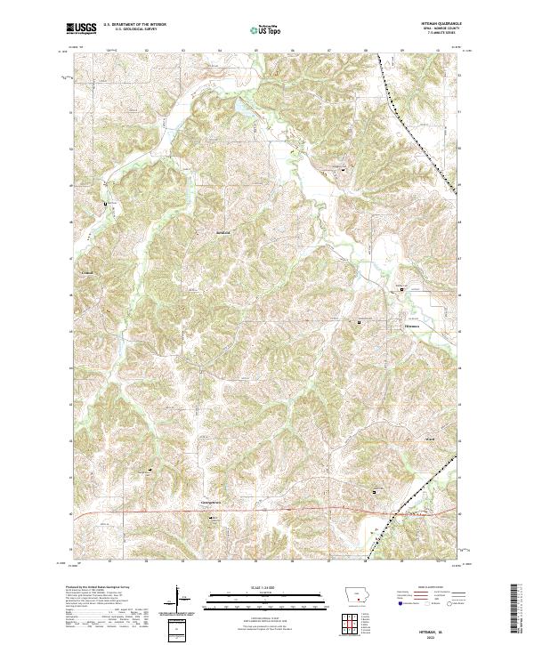
2022 Map of Hiteman
USGS Topo · Published 2022About this map
Hiteman and its surrounding townships in Monroe County are defined by a network of rural settlements and family-named cemeteries. This modern survey illustrates the persistent layout of these historical communities, showing how Georgetown and Ward remain anchored to the landscape by the drainage basins of Cedar Cr and Whippoorwill Cr. The distribution of burial grounds such as Saint Patricks Cem, Abegglen Cem, and Bell Cem provides essential spatial data for genealogists tracing local families across these rolling sections. The terrain is marked by distinct valleys where Whites Cr and Bee Br have shaped the placement of early roads like Co RD h32 and Co RD t19, reflecting a pattern of settlement that follows the natural contours of the Iowa countryside.
Find a feature on this map
64 named features on this map. Tap any name to fly to it.
Don’t see what you’re looking for? This feature index may not catch every label — zoom into the map to look around manually.
Map Details
Editions of this 2022 Hiteman Map
This is the sole edition of this map. No revisions or reprints were ever made.
Other maps of this area

1924 · Melcher
USGS Topo · 1:62,500

1929 · Albia
USGS Topo · 1:62,500

1935 · Russell
USGS Topo · 1:62,500

1938 · Russell
USGS Topo · 1:62,500

1939 · Mystic
USGS Topo · 1:62,500

1942 · Mystic
USGS Topo · 1:62,500

1954 · Centerville
USGS Topo · 1:250,000

1954 · Des Moines
USGS Topo · 1:250,000

1956 · Des Moines
USGS Topo · 1:250,000

1957 · Des Moines
USGS Topo · 1:250,000