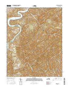
2016 Map of Hiwassee
USGS Topo · Published 2016About this map
Claytor Lake and the winding course of the New River dominate this portion of the New River Valley, where the borders of Pulaski, Carroll, Wythe, and Floyd counties converge. The settlement of Hiwassee sits central to a landscape defined by sharp ridges and deep hollows, such as Matheny Hollow and Rustin Hollow. Local history is anchored by numerous family burial grounds and community landmarks, including Hurst Cem, Marshall Cem, and Bethel Ch.
Find a feature on this map
100 named features on this map. Tap any name to fly to it.
Don’t see what you’re looking for? This feature index may not catch every label — zoom into the map to look around manually.
Map Details
Editions of this 2016 Hiwassee Map
This is the sole edition of this map. No revisions or reprints were ever made.
Other maps of this area

1889 · Hillsville
USGS Topo · 1:125,000

1890 · Dublin
USGS Topo · 1:125,000

1891 · Dublin
USGS Topo · 1:125,000

1892 · Hillsville
USGS Topo · 1:125,000

1896 · Hillsville
USGS Topo · 1:125,000

1930 · Max Meadows
USGS Topo · 1:62,500

1934 · Pulaski
USGS Topo · 1:48,000

1940 · Pulaski
USGS Topo · 1:62,500

1950 · Radford
USGS Topo · 1:62,500

1953 · Winston-Salem
USGS Topo · 1:250,000