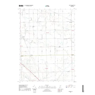
2019 Map of Hoagland
USGS Topo · Published 2019About this map
Monroeville and Hoagland anchor this agricultural landscape in southeastern Allen County, where the topography is defined by an intricate network of drainage systems such as Hoffman Lepper Ditch and Ellison Ditch. The map illustrates a highly managed rural environment, where natural waterways like the Saint Marys River are supplemented by dozens of engineered drains to support the flat farmland. Small, historically significant points of settlement like Boston Corner and Williams sit at the intersections of a rigid grid of county roads. For those researching local heritage, the map identifies several distinct burial grounds, including the Saint Johns Lutheran Flat Rock Cem and the Brown Family Cem, providing precise locations for family history research. Modern recreational use is represented by the Heritage Snowmobile Trail (Snow), which threads through the fields and along section lines.
Find a feature on this map
59 named features on this map. Tap any name to fly to it.
Don’t see what you’re looking for? This feature index may not catch every label — zoom into the map to look around manually.
Map Details
Editions of this 2019 Hoagland Map
This is the sole edition of this map. No revisions or reprints were ever made.
Other maps of this area

1953 · Fort Wayne
USGS Topo · 1:250,000

1953 · Muncie
USGS Topo · 1:250,000

1956 · Muncie
USGS Topo · 1:250,000

1956 · Fort Wayne
USGS Topo · 1:250,000

1956 · Fort Wayne East
USGS Topo · 1:24,000

1957 · Maples
USGS Topo · 1:24,000

1958 · Woodburn South
USGS Topo · 1:24,000

1960 · Dixon
USGS Topo · 1:24,000
1960 · Wren
USGS Topo · 1:24,000

1961 · Hoagland
USGS Topo · 1:24,000