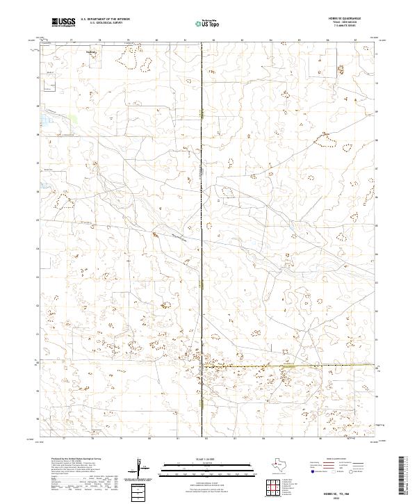
2022 Map of Hobbs SE
USGS Topo · Published 2022About this map
Nadine stands as a focal point in this high-plains landscape where the borders of West Texas and Southeast New Mexico meet. The topography is defined by the subtle drainage of Monument Draw, which meanders southeastward across the state line between Lea County and Gaines County. This modern survey reflects the grid-based development of the Llano Estacado, characterized by a network of rural routes including E Nadine Rd and McCasland Rd. Local land naming conventions are preserved through labels like Water Dog, while the underlying Public Land Survey System divisions—such as t20s r39e—illustrate the structured organization of this ranching and energy-producing corridor. The map provides a precise view of the transition from the New Mexico plains into the Gaines and Andrews County line area in Texas.
Find a feature on this map
19 named features on this map. Tap any name to fly to it.
Don’t see what you’re looking for? This feature index may not catch every label — zoom into the map to look around manually.
Map Details
Editions of this 2022 Hobbs SE Map
This is the sole edition of this map. No revisions or reprints were ever made.
Other maps of this area

1954 · Hobbs
USGS Topo · 1:250,000

1958 · Hobbs
USGS Topo · 1:250,000

1969 · Hobbs SW
USGS Topo · 1:24,000

1969 · Hobbs East
USGS Topo · 1:24,000

1969 · Eunice
USGS Topo · 1:24,000

1969 · Hobbs SE
USGS Topo · 1:24,000

1969 · Eunice NE
USGS Topo · 1:24,000

1969 · Hobbs West
USGS Topo · 1:24,000

1971 · Brinson Ranch
USGS Topo · 1:24,000

1971 · Jumbo Hill
USGS Topo · 1:24,000