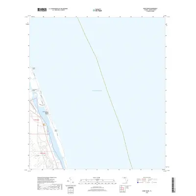
2018 Map of Hobe Sound
USGS Topo · Published 2018About this map
Jupiter Island and the coastal barrier system of Martin County dominate this topographic landscape, where the Atlantic coast meets a complex network of lagoons and narrows. The area is defined by its narrow strips of land and the vital Intracoastal Waterway, which separates the island from the mainland. The geography here is a delicate balance of water and sand, featuring the Indian River Lagoon and the sheltered waters of Hobe Sound. Infrastructure like the Hobe Sound Bridge and N Beach Rd provide the primary connections between these isolated coastal communities and the mainland. Residential developments are tucked between the Atlantic Ocean and the inner waterways, as seen in the layout of Bonair Beach and the roads winding toward Harbor Island. The map illustrates a high-end coastal environment where land use is dictated by the immediate proximity to the sea and the navigational channels of the lagoon.
Find a feature on this map
18 named features on this map. Tap any name to fly to it.
Don’t see what you’re looking for? This feature index may not catch every label — zoom into the map to look around manually.
Map Details
Editions of this 2018 Hobe Sound Map
This is the sole edition of this map. No revisions or reprints were ever made.
Other maps of this area

1948 · Rood
USGS Topo · 1:24,000

1948 · St. Lucie Inlet
USGS Topo · 1:24,000

1948 · Gomez
USGS Topo · 1:24,000

1948 · Hobe Sound
USGS Topo · 1:24,000

1948 · Jupiter
USGS Topo · 1:24,000

1949 · Rood
USGS Topo · 1:24,000

1949 · Gomez
USGS Topo · 1:24,000

1949 · Hobe Sound
USGS Topo · 1:24,000

1950 · St. Lucie Inlet
USGS Topo · 1:24,000

1950 · Jupiter
USGS Topo · 1:24,000