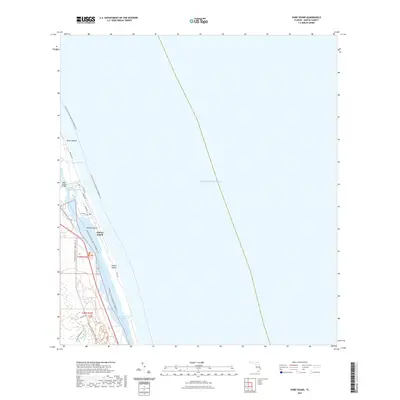
2021 Map of Hobe Sound
USGS Topo · Published 2021About this map
Jupiter Island and the barrier coast of Martin County are defined here by a complex network of coastal waterways and modern conservation trails. The landscape is bisected by the Intracoastal Waterway and the Indian River Lagoon, providing a detailed look at the aquatic arteries that separate the mainland from the Atlantic shore. This 2021 survey highlights the contemporary infrastructure of the region, including the Hobe Sound Bridge and residential corridors like Gomez Rd and Riverview Rd. Land-water connectivity is a central theme, shown through the Florida Circumnavigational Paddling Trl and the Jonathan Dickinson State Park Trl, which navigate the fringes of Hobe Sound and the South Jupiter Narrows. From the quiet waters of Lake Francis to the southern reach of the N Fork Loxahatchee River, the map captures the environmental and recreational layout of a premier Florida coastal community.
Find a feature on this map
22 named features on this map. Tap any name to fly to it.
Don’t see what you’re looking for? This feature index may not catch every label — zoom into the map to look around manually.
Map Details
Editions of this 2021 Hobe Sound Map
This is the sole edition of this map. No revisions or reprints were ever made.
Other maps of this area

1948 · Rood
USGS Topo · 1:24,000

1948 · St. Lucie Inlet
USGS Topo · 1:24,000

1948 · Gomez
USGS Topo · 1:24,000

1948 · Hobe Sound
USGS Topo · 1:24,000

1948 · Jupiter
USGS Topo · 1:24,000

1949 · Rood
USGS Topo · 1:24,000

1949 · Gomez
USGS Topo · 1:24,000

1949 · Hobe Sound
USGS Topo · 1:24,000

1950 · St. Lucie Inlet
USGS Topo · 1:24,000

1950 · Jupiter
USGS Topo · 1:24,000