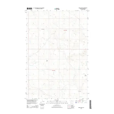
2014 Map of Hobo Coulee
USGS Topo · Published 2014About this map
Hobo Coulee defines the drainage patterns of this Rosebud County landscape, where deep erosional channels and intermittent streambeds mark a classic Western rangeland. The topography is dominated by the winding course of S Sunday Cr, which is fed by smaller tributaries including Louie and Scottie Cr and Coal Cr. Human infrastructure in this arid region is focused on water management, evidenced by the Donald Reservoir positioned near the eastern margins of the quadrangle. The map reveals the intricate network of coulees, such as Rose Coulee, and the distinct drainage of Bow and Arrow Cr, illustrating the rugged and dissected nature of the Montana plains at the time of the 2014 survey. Section lines from t10n r44e and t9n r44e provide the primary framework for land division across this expansive territory.
Find a feature on this map
9 named features on this map. Tap any name to fly to it.
Don’t see what you’re looking for? This feature index may not catch every label — zoom into the map to look around manually.
Map Details
Editions of this 2014 Hobo Coulee Map
This is the sole edition of this map. No revisions or reprints were ever made.
Other maps of this area

1954 · Forsyth
USGS Topo · 1:250,000

1957 · Forsyth
USGS Topo · 1:250,000

1958 · Forsyth
USGS Topo · 1:250,000

1968 · Sand Buttes
USGS Topo · 1:24,000

1968 · Butterfly Creek
USGS Topo · 1:24,000

1968 · Hathaway NW
USGS Topo · 1:24,000
1969 · Angela NE
USGS Topo · 1:24,000

1969 · Wild Horse Pass SE
USGS Topo · 1:24,000
1969 · N Bar Coulee
USGS Topo · 1:24,000
1969 · Alkali Creek
USGS Topo · 1:24,000