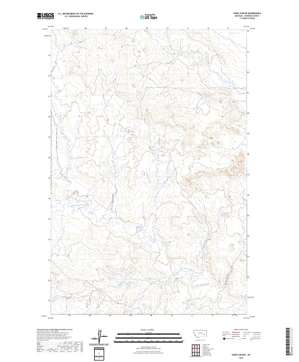
2024 Map of Hobo Coulee
USGS Topo · Published 2024About this map
Hobo Coulee carves through the central portion of this Rosebud County landscape, illustrating the drainage patterns typical of eastern Montana’s high plains. The terrain is defined by the winding paths of South Sunday Creek and its southern counterpart, South-Sunday Creek, which weave through the townships of T10N R44E and T9N R44E. These seasonal watercourses are supplemented by smaller tributaries like Louie and Scottie Creek, providing essential water access in an otherwise arid environment. Evidence of human modification for ranching and land management is visible at Donald Reservoir in the eastern reaches of the map. The spatial distribution of these features, alongside the naming of Rose Coulee, reflects the long-standing ranching tradition and the importance of specific water sources in this sparsely settled region.
Find a feature on this map
10 named features on this map. Tap any name to fly to it.
Don’t see what you’re looking for? This feature index may not catch every label — zoom into the map to look around manually.
Map Details
Editions of this 2024 Hobo Coulee Map
This is the sole edition of this map. No revisions or reprints were ever made.
Other maps of this area

1954 · Forsyth
USGS Topo · 1:250,000

1957 · Forsyth
USGS Topo · 1:250,000

1958 · Forsyth
USGS Topo · 1:250,000

1968 · Sand Buttes
USGS Topo · 1:24,000

1968 · Butterfly Creek
USGS Topo · 1:24,000

1968 · Hathaway NW
USGS Topo · 1:24,000
1969 · Angela NE
USGS Topo · 1:24,000

1969 · Wild Horse Pass SE
USGS Topo · 1:24,000
1969 · N Bar Coulee
USGS Topo · 1:24,000
1969 · Alkali Creek
USGS Topo · 1:24,000