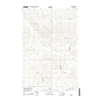
2014 Map of Hodges
USGS Topo · Published 2014About this map
Hodges stands as a primary point of interest in this eastern Montana landscape, where the high plains are carved by an intricate network of seasonal drainage systems. The terrain is defined by the headwaters and winding paths of Hodges Cr, Glendive Cr, and Horse Cr, illustrating the typical erosion patterns of the region. This 2014 survey captures the rural infrastructure of the borderlands between Dawson and Wibaux counties, anchored by a grid of section lines and gravel routes such as Road 118 and Road 159.
Find a feature on this map
16 named features on this map. Tap any name to fly to it.
Don’t see what you’re looking for? This feature index may not catch every label — zoom into the map to look around manually.
Map Details
Editions of this 2014 Hodges Map
This is the sole edition of this map. No revisions or reprints were ever made.
Other maps of this area

1909 · Glendive
USGS Topo · 1:250,000

1953 · Miles City
USGS Topo · 1:250,000

1954 · Glendive
USGS Topo · 1:250,000

1957 · Miles City
USGS Topo · 1:250,000

1957 · Glendive
USGS Topo · 1:250,000

1958 · Miles City
USGS Topo · 1:250,000

1958 · Glendive
USGS Topo · 1:250,000

1967 · Allard
USGS Topo · 1:24,000

1967 · Twin Forks Reservoir
USGS Topo · 1:24,000

1981 · Glendive
USGS Topo · 1:100,000