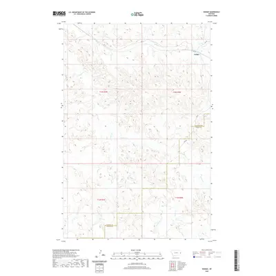
2020 Map of Hodges
USGS Topo · Published 2020About this map
Hodges sits in the northeastern corner of this Montana landscape, marking a concentrated point of settlement where several rural roads converge. The terrain is defined by a dense network of drainages and intermittent streams that carve through the high plains, including Hodges Cr and the winding course of Glendive Cr. This topography reflects the hydrological complexity of the region, where waterways like Eastman Cr and Freeman Cr dictate the natural corridors of movement and land use. The boundary between Dawson Co and Wibaux Co bisects the eastern portion of the map, illustrating the administrative divisions in this sparsely populated cattle and farming country. Along the southern reaches, S Fork Horse Cr and Wolf Cr further delineate the rugged breaks and coulees that characterize the local geography.
Find a feature on this map
17 named features on this map. Tap any name to fly to it.
Don’t see what you’re looking for? This feature index may not catch every label — zoom into the map to look around manually.
Map Details
Editions of this 2020 Hodges Map
This is the sole edition of this map. No revisions or reprints were ever made.
Other maps of this area

1909 · Glendive
USGS Topo · 1:250,000

1953 · Miles City
USGS Topo · 1:250,000

1954 · Glendive
USGS Topo · 1:250,000

1957 · Miles City
USGS Topo · 1:250,000

1957 · Glendive
USGS Topo · 1:250,000

1958 · Miles City
USGS Topo · 1:250,000

1958 · Glendive
USGS Topo · 1:250,000

1967 · Allard
USGS Topo · 1:24,000

1967 · Twin Forks Reservoir
USGS Topo · 1:24,000

1981 · Glendive
USGS Topo · 1:100,000