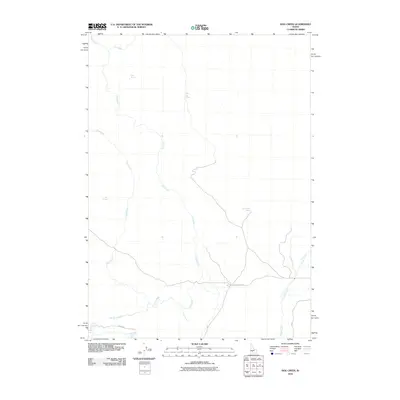
2010 Map of Hog Creek
USGS Topo · Published 2010About this map
Hog Creek and Dry Creek dominate this high-desert drainage system in Elmore County, revealing a landscape defined by its scattered water sources. This 2010 survey illustrates the remote character of the region, where critical watering points like Dead Horse Spring, Echo Spring, and Hat Spring are the primary landmarks. The presence of Cedar Tree Spring and Warm Spring suggests the vital importance of these perennial features in an otherwise arid environment. Settlement and infrastructure are minimal, with only Clover Creek Rd and Knox Rd providing access through the terrain. The map captures the complex network of seasonal and permanent watercourses, including Clover Creek and the small Golf Creek drainage, at a time when traditional land use in this part of Idaho remained centered on these essential riparian corridors.
Find a feature on this map
12 named features on this map. Tap any name to fly to it.
Don’t see what you’re looking for? This feature index may not catch every label — zoom into the map to look around manually.
Map Details
Editions of this 2010 Hog Creek Map
This is the sole edition of this map. No revisions or reprints were ever made.
Other maps of this area

1892 · Camas Prairie
USGS Topo · 1:125,000

1893 · Camas Prairie
USGS Topo · 1:125,000

1947 · Pasadena Valley
USGS Topo · 1:24,000

1948 · Pasadena Valley
USGS Topo · 1:24,000

1948 · Ticeska
USGS Topo · 1:24,000

1949 · Ticeska
USGS Topo · 1:24,000

1949 · Pasadena Valley
USGS Topo · 1:62,500

1949 · Bliss
USGS Topo · 1:24,000

1950 · Bliss
USGS Topo · 1:24,000

1955 · Twin Falls
USGS Topo · 1:250,000