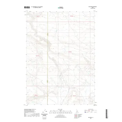
2020 Map of Hog Creek
USGS Topo · Published 2020About this map
Thorn Cr and Dry Cr carve through the high terrain of this remote portion of southern Idaho, where the landscape is defined by its seasonal water sources and deep drainage patterns. This recent survey by the U.S. Geological Survey documents a territory marked by numerous named springs, including Echo Spring, Cedar Tree Spring, and Dead Horse Spring, which indicate critical water points in an otherwise arid environment. The border between Elmore County and Gooding County runs vertically through the center of the sheet, bisecting the drainage of Clover Creek. Transportation in the area is sparse, primarily concentrated along the historical Old Clover Creek Rd and the irrigation infrastructure of Lateral Y-9 in the southern sections. The map provides a precise record of the public land survey system divisions, showing the township and range lines that have organized these ranching and grazing lands for generations.
Find a feature on this map
19 named features on this map. Tap any name to fly to it.
Don’t see what you’re looking for? This feature index may not catch every label — zoom into the map to look around manually.
Map Details
Editions of this 2020 Hog Creek Map
This is the sole edition of this map. No revisions or reprints were ever made.
Other maps of this area

1892 · Camas Prairie
USGS Topo · 1:125,000

1893 · Camas Prairie
USGS Topo · 1:125,000

1947 · Pasadena Valley
USGS Topo · 1:24,000

1948 · Pasadena Valley
USGS Topo · 1:24,000

1948 · Ticeska
USGS Topo · 1:24,000

1949 · Ticeska
USGS Topo · 1:24,000

1949 · Pasadena Valley
USGS Topo · 1:62,500

1949 · Bliss
USGS Topo · 1:24,000

1950 · Bliss
USGS Topo · 1:24,000

1955 · Twin Falls
USGS Topo · 1:250,000