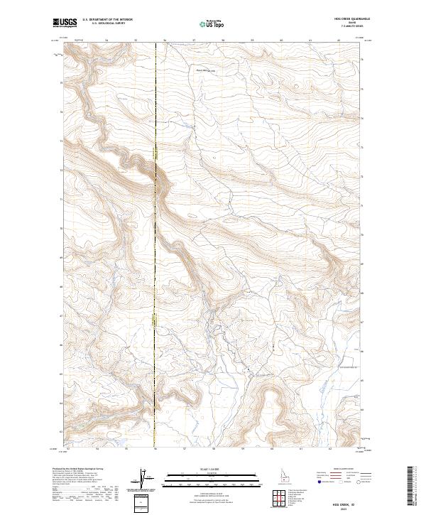
2023 Map of Hog Creek
USGS Topo · Published 2023About this map
The Mount Bennett Hills dominate this high-desert landscape in south-central Idaho, where the county line separates Elmore and Gooding counties. This terrain is defined by a network of drainage systems and isolated water sources that were historically vital for livestock and early travel through the region. Seasonal waterways like Dry Creek and Hog Creek carve through the elevation, while a series of named springs—including Echo Spring, Cedar Tree Spring, and Dead Horse Spring—indicate the precarious nature of water access in this environment.
Find a feature on this map
19 named features on this map. Tap any name to fly to it.
Don’t see what you’re looking for? This feature index may not catch every label — zoom into the map to look around manually.
Map Details
Editions of this 2023 Hog Creek Map
This is the sole edition of this map. No revisions or reprints were ever made.
Other maps of this area

1892 · Camas Prairie
USGS Topo · 1:125,000

1893 · Camas Prairie
USGS Topo · 1:125,000

1947 · Pasadena Valley
USGS Topo · 1:24,000

1948 · Pasadena Valley
USGS Topo · 1:24,000

1948 · Ticeska
USGS Topo · 1:24,000

1949 · Ticeska
USGS Topo · 1:24,000

1949 · Pasadena Valley
USGS Topo · 1:62,500

1949 · Bliss
USGS Topo · 1:24,000

1950 · Bliss
USGS Topo · 1:24,000

1955 · Twin Falls
USGS Topo · 1:250,000