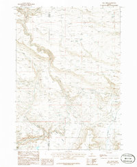
1986 Map of Hog Creek
USGS Topo · Published 1986About this map
The high desert terrain of south-central Idaho is defined by its seasonal water sources and steep drainage systems along the Elmore and Gooding County line. During the mid-1980s, this landscape was primarily used for open-range grazing and resource extraction, marked by the presence of a Gravel Pit and numerous isolated water points essential for livestock. Notable springs like Dead Horse Spring, Cedar Tree Spring, and Echo Spring dot the highlands, providing rare relief in an area dominated by the deep incisions of Hog Creek and Clover Creek. A lonely Cem stands as a testament to the early settlers who attempted to find a foothold in this challenging environment. The map also traces the path of a high-voltage Trans Line, showing the modern infrastructure cutting through traditional canyon lands near Thorn Creek and Dry Creek.
Find a feature on this map
16 named features on this map. Tap any name to fly to it.
Don’t see what you’re looking for? This feature index may not catch every label — zoom into the map to look around manually.
Map Details
Editions of this 1986 Hog Creek Map
This is the sole edition of this map. No revisions or reprints were ever made.
Other maps of this area

1892 · Camas Prairie
USGS Topo · 1:125,000

1893 · Camas Prairie
USGS Topo · 1:125,000

1947 · Pasadena Valley
USGS Topo · 1:24,000

1948 · Pasadena Valley
USGS Topo · 1:24,000

1948 · Ticeska
USGS Topo · 1:24,000

1949 · Ticeska
USGS Topo · 1:24,000

1949 · Pasadena Valley
USGS Topo · 1:62,500

1949 · Bliss
USGS Topo · 1:24,000

1950 · Bliss
USGS Topo · 1:24,000

1955 · Twin Falls
USGS Topo · 1:250,000