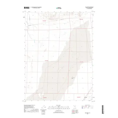
2018 Map of Hog Spring
USGS Topo · Published 2018About this map
Hog Spring and the drainage of Buffalo Slough define this section of the Smoke Creek Desert, where the Great Basin landscape is marked by intermittent water sources and ephemeral basins. The geography here is primarily shaped by the vast desert flats and the sparse infrastructure of northwestern Nevada, with the map recording the exact township and range boundaries such as t32n r20e and t31n r21e. Human presence is concentrated along a few key corridors, notably Surprise Valley Rd and Buffalo Meadows Rd, which provide access through the open terrain. Near the southern edge, the small location of Reynard stands as a distinct point of interest within this otherwise wide-open expanse, offering a precise look at the land survey system and hydrography of the region in the early 21st century.
Find a feature on this map
11 named features on this map. Tap any name to fly to it.
Don’t see what you’re looking for? This feature index may not catch every label — zoom into the map to look around manually.
Map Details
Editions of this 2018 Hog Spring Map
This is the sole edition of this map. No revisions or reprints were ever made.
Other maps of this area

1886 · Granite Range
USGS Topo · 1:250,000

1894 · Granite Range
USGS Topo · 1:250,000

1955 · Lovelock
USGS Topo · 1:250,000

1959 · Lovelock
USGS Topo · 1:250,000

1965 · Fox Range
USGS Topo · 1:62,500

1980 · Salt Marsh
USGS Topo · 1:24,000
1980 · Buffalo Creek
USGS Topo · 1:24,000

1980 · Hog Spring
USGS Topo · 1:24,000

1980 · Wall Spring
USGS Topo · 1:24,000

1980 · Smith Canyon
USGS Topo · 1:24,000