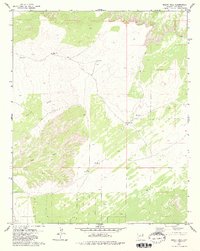
1979 Map of Hogan Well
USGS Topo · Published 1980About this map
Puerco Ridge dominates this high-desert landscape in Apache County, captured during a 1972 aerial survey and field checked in the mid-1970s. The region is defined by a sparse network of ranching and utility infrastructure, where water sources like Hogan Well and Jenson Well served as critical landmarks for navigating the arid terrain. The presence of multiple Gas Well sites and Water Tank locations suggests a landscape utilized for both energy extraction and livestock management during the late twentieth century.
Find a feature on this map
10 named features on this map. Tap any name to fly to it.
Don’t see what you’re looking for? This feature index may not catch every label — zoom into the map to look around manually.
Map Details
Editions of this 1979 Hogan Well Map
2 editions found
Other maps of this area

1886 · St Johns
USGS Topo · 1:250,000

1886 · Fort Defiance
USGS Topo · 1:250,000

1892 · Fort Defiance
USGS Topo · 1:250,000

1892 · St Johns
USGS Topo · 1:250,000

1954 · Saint Johns
USGS Topo · 1:250,000

1954 · Gallup
USGS Topo · 1:250,000

1957 · Saint Johns
USGS Topo · 1:250,000

1958 · Gallup
USGS Topo · 1:250,000

1958 · Saint Johns
USGS Topo · 1:250,000

1959 · Gallup
USGS Topo · 1:250,000