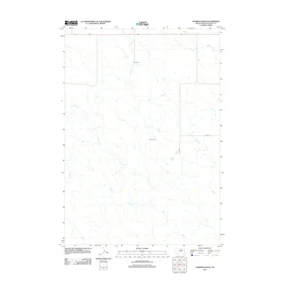
2012 Map of Hohrman Ranch
USGS Topo · Published 2012About this map
Hohrman Ranch and White Ranch sit atop the open drainage systems of Stanley County, marking the sparse residential footprint of this prairie landscape. The area is defined by the winding paths of several intermittent waterways, including the extensively branched Frozen Man Creek and Plum Creek, which carve subtle topography through the plains. Local infrastructure is minimal, consisting primarily of section-line roads like 261st Ave and 213th St. This 2012 survey illustrates the enduring nature of South Dakota's ranching country, where large landholdings are organized around vital water sources like Brush Creek. The map provides a precise view of the rural grid and natural drainage patterns that have dictated land use in the region for generations.
Find a feature on this map
7 named features on this map. Tap any name to fly to it.
Don’t see what you’re looking for? This feature index may not catch every label — zoom into the map to look around manually.
Map Details
Editions of this 2012 Hohrman Ranch Map
This is the sole edition of this map. No revisions or reprints were ever made.
Other maps of this area

1951 · Van Metre
USGS Topo · 1:24,000

1951 · Capa NW
USGS Topo · 1:24,000

1954 · Pierre
USGS Topo · 1:250,000

1958 · Pierre
USGS Topo · 1:250,000

1980 · Princes Ranch
USGS Topo · 1:25,000
1982 · Doty Ridge
USGS Topo · 1:24,000

1982 · Hayes South
USGS Topo · 1:24,000

1982 · Hohrman Ranch
USGS Topo · 1:24,000
1982 · Midland NE
USGS Topo · 1:24,000

1983 · Hayes North
USGS Topo · 1:24,000