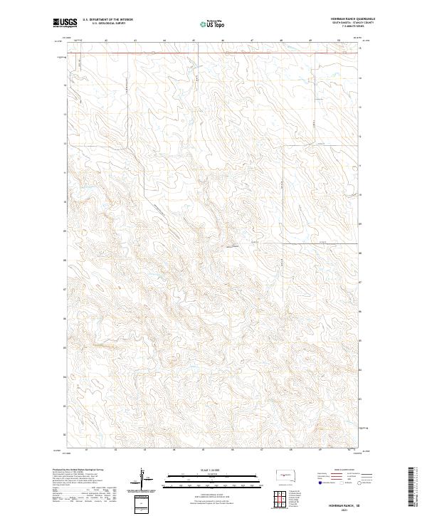
2021 Map of Hohrman Ranch
USGS Topo · Published 2021About this map
Hohrman Ranch serves as a central landmark in this portion of Stanley County, reflecting the enduring ranching character of the South Dakota landscape in the early 2020s. The terrain is defined by a series of intermittent drainages including Frozen Man Cr, Plum Cr, and Brush Cr, which carve through the high plains. This contemporary survey details the section lines and rural infrastructure that organize the territory, featuring a network of local routes such as Co Rd 519 and Co Rd 520. The spatial layout reveals the low-density settlement patterns typical of this region, where large landholdings are connected by long stretches of gravel roads like Diamond Willow PL and 256th Ave.
Find a feature on this map
19 named features on this map. Tap any name to fly to it.
Don’t see what you’re looking for? This feature index may not catch every label — zoom into the map to look around manually.
Map Details
Editions of this 2021 Hohrman Ranch Map
This is the sole edition of this map. No revisions or reprints were ever made.
Other maps of this area

1951 · Van Metre
USGS Topo · 1:24,000

1951 · Capa NW
USGS Topo · 1:24,000

1954 · Pierre
USGS Topo · 1:250,000

1958 · Pierre
USGS Topo · 1:250,000

1980 · Princes Ranch
USGS Topo · 1:25,000
1982 · Doty Ridge
USGS Topo · 1:24,000

1982 · Hayes South
USGS Topo · 1:24,000

1982 · Hohrman Ranch
USGS Topo · 1:24,000
1982 · Midland NE
USGS Topo · 1:24,000

1983 · Hayes North
USGS Topo · 1:24,000