
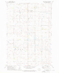
1968 Map of Holabird
USGS Topo · Published 1971About this map
The small settlement of Holabird sits along the southern edge of this Central South Dakota landscape, positioned precisely where the Chicago and North Western railroad cuts through the prairie. During the late 1960s, this area of Hyde County was defined by its sparse agrarian footprint, evidenced by the presence of Loomis Sch and a network of section lines dividing the townships of Loomis and Lincoln. The drainage of the South Fork Medicine Knoll Creek meanders through the southern portion of the quadrangle, serving as a primary water source in a region where isolated wells and several instances of a Flowing Well were critical for sustaining livestock and homesteads. The map provides a detailed view of the infrastructure supporting a remote ranching economy, from the railroad corridor to the specific township boundaries of Highmore and its neighbors.
Find a feature on this map
12 named features on this map. Tap any name to fly to it.
Don’t see what you’re looking for? This feature index may not catch every label — zoom into the map to look around manually.
Map Details
Editions of this 1968 Holabird Map
This is the sole edition of this map. No revisions or reprints were ever made.
Other maps of this area

1949 · Mitchell Lake
USGS Topo · 1:24,000

1950 · Mitchell Lake
USGS Topo · 1:24,000

1950 · Highmore
USGS Topo · 1:24,000

1953 · Huron
USGS Topo · 1:250,000

1954 · Huron
USGS Topo · 1:250,000

1968 · Harrold NW
USGS Topo · 1:24,000

1968 · Harrold
USGS Topo · 1:24,000

1968 · Harrold NE
USGS Topo · 1:24,000

1973 · Chapelle Lake
USGS Topo · 1:24,000
1973 · Macs Corner NW
USGS Topo · 1:24,000