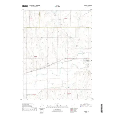
2017 Map of Holbrook
USGS Topo · Published 2017About this map
The Republican River valley defines the character of this Furnas County landscape, where agriculture is shaped by an extensive network of irrigation infrastructure. The village of Holbrook serves as the central hub of the region, situated along the northern banks of the river and a primary transportation corridor. To the south and west, the terrain is marked by significant topographical shifts including Wild Horse Canyon and Smith Canyon, which contrast with the level plains of the river bottom.
Find a feature on this map
42 named features on this map. Tap any name to fly to it.
Don’t see what you’re looking for? This feature index may not catch every label — zoom into the map to look around manually.
Map Details
Editions of this 2017 Holbrook Map
This is the sole edition of this map. No revisions or reprints were ever made.
Other maps of this area

1896 · Arapahoe
USGS Topo · 1:125,000

1898 · Arapahoe
USGS Topo · 1:125,000

1954 · McCook
USGS Topo · 1:250,000

1955 · Grand Island
USGS Topo · 1:250,000

1956 · Cambridge
USGS Topo · 1:24,000

1956 · Medicine Creek Dam
USGS Topo · 1:24,000

1957 · McCook
USGS Topo · 1:250,000

1957 · Grand Island
USGS Topo · 1:250,000

1958 · McCook
USGS Topo · 1:250,000

1958 · Grand Island
USGS Topo · 1:250,000