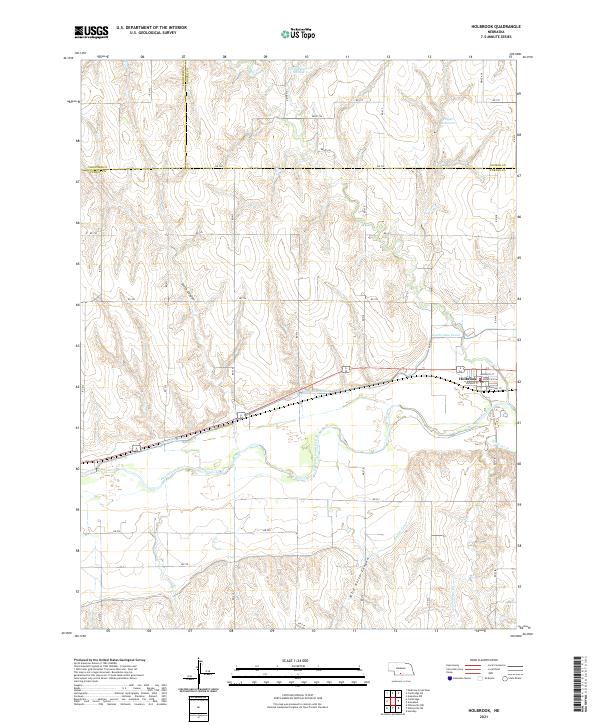
2021 Map of Holbrook
USGS Topo · Published 2021About this map
Holbrook sits at the heart of this agricultural and water-management landscape, where the town grid is defined by streets like Norwich St and Ontario St. The valley is dominated by the Republican River, which flows across the southern half of the quadrangle, flanked by an extensive irrigation network including the Cambridge Canal and Bartley Canal. These man-made waterways illustrate the vital role of water engineering in the High Plains, carving through a landscape otherwise marked by natural drainages like Smith Canyon and Wild Horse Canyon. The northern reaches of the area contain elevated water storage features such as Gross Reservoir Number 2 and Hilger Reservoir, positioned near the borders where Furnas, Frontier, and Gosper counties meet. The confluence of Deer Creek and Timmons Creek into the main river valley further defines the local topography, supporting the farming operations that sustain this Nebraska community.
Find a feature on this map
42 named features on this map. Tap any name to fly to it.
Don’t see what you’re looking for? This feature index may not catch every label — zoom into the map to look around manually.
Map Details
Editions of this 2021 Holbrook Map
This is the sole edition of this map. No revisions or reprints were ever made.
Other maps of this area

1896 · Arapahoe
USGS Topo · 1:125,000

1898 · Arapahoe
USGS Topo · 1:125,000

1954 · McCook
USGS Topo · 1:250,000

1955 · Grand Island
USGS Topo · 1:250,000

1956 · Cambridge
USGS Topo · 1:24,000

1956 · Medicine Creek Dam
USGS Topo · 1:24,000

1957 · McCook
USGS Topo · 1:250,000

1957 · Grand Island
USGS Topo · 1:250,000

1958 · McCook
USGS Topo · 1:250,000

1958 · Grand Island
USGS Topo · 1:250,000