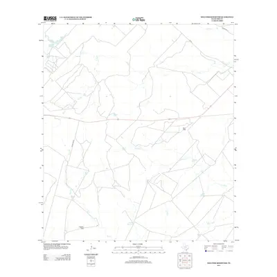
2013 Map of Holcomb Reservoir
USGS Topo · Published 2013About this map
English Hills rises above a landscape defined by ranching infrastructure and intermittent water sources in Frio County. This 2013 survey documents a network of private water tanks, such as English Hills Tank, Tutiga Tank, and Llave Tank, which are vital for supporting livestock in this South Texas environment. The Frio River and its many tributaries, including Elm Cr and Jack Cr, cross the terrain, though many appear as seasonal drainages rather than permanent flows. Notable landmarks include the prominent elevation of Pilot Knob and the Holcomb Reservoir in the northwestern corner. The area is served by local transit routes like Leona River Rd and FM-140, connecting the dispersed rural holdings and water features that characterize the region's agricultural economy.
Find a feature on this map
23 named features on this map. Tap any name to fly to it.
Don’t see what you’re looking for? This feature index may not catch every label — zoom into the map to look around manually.
Map Details
Editions of this 2013 Holcomb Reservoir Map
This is the sole edition of this map. No revisions or reprints were ever made.
Other maps of this area

1925 · Pearsall 1-b
USGS Topo · 1:48,000

1925 · Pearsall 1-c
USGS Topo · 1:48,000

1927 · Pearsall
USGS Topo · 1:62,500

1928 · Frio Town
USGS Topo · 1:62,500

1942 · Divot
USGS Topo · 1:62,500

1953 · Crystal City
USGS Topo · 1:250,000

1954 · San Antonio
USGS Topo · 1:250,000

1955 · Crystal City
USGS Topo · 1:250,000

1956 · Divot
USGS Topo · 1:62,500

1957 · San Antonio
USGS Topo · 1:250,000