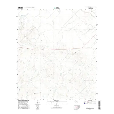
2016 Map of Holcomb Reservoir
USGS Topo · Published 2016About this map
Pilot Knob and the English Hills command the topography of this corner of Frio County, where the landscape is defined by an intricate network of drainage and water management. The namesake Holcomb Reservoir sits in the northwest, feeding into a system of seasonal watercourses including Elm Cr and Jack Cr. The prevalence of named stock tanks, such as Willow Tank, Garden Tank, and English Hills Tank, reflects the region's ranching heritage and the vital importance of water storage in this semi-arid South Texas environment. Ranch roads and state routes like W FM 140 weave between these landmarks, while the Frio River makes a brief appearance in the northeast. This 2016 survey illustrates how the natural topography of ridges and hollows, including Goat Hollow Cr and Live Oak Cr, has been adapted for agricultural use through the placement of these numerous tanks and catchments.
Find a feature on this map
23 named features on this map. Tap any name to fly to it.
Don’t see what you’re looking for? This feature index may not catch every label — zoom into the map to look around manually.
Map Details
Editions of this 2016 Holcomb Reservoir Map
This is the sole edition of this map. No revisions or reprints were ever made.
Other maps of this area

1925 · Pearsall 1-b
USGS Topo · 1:48,000

1925 · Pearsall 1-c
USGS Topo · 1:48,000

1927 · Pearsall
USGS Topo · 1:62,500

1928 · Frio Town
USGS Topo · 1:62,500

1942 · Divot
USGS Topo · 1:62,500

1953 · Crystal City
USGS Topo · 1:250,000

1954 · San Antonio
USGS Topo · 1:250,000

1955 · Crystal City
USGS Topo · 1:250,000

1956 · Divot
USGS Topo · 1:62,500

1957 · San Antonio
USGS Topo · 1:250,000