
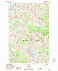
1988 Map of Holden
USGS Topo · Published 1995About this map
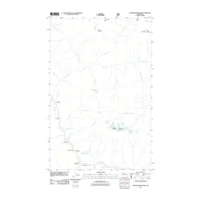
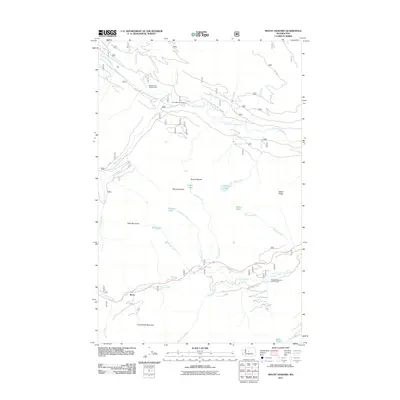
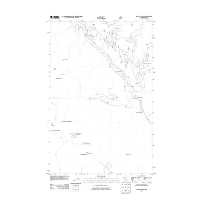
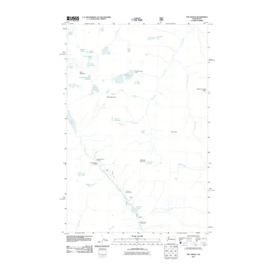
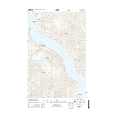
Holden sits as a significant industrial outpost deep within the Wenatchee National Forest, centered on a large-scale mining operation at the base of Copper Peak. The landscape is heavily marked by this extraction economy, featuring prominent Tailings piles, Dumps, and a Sewage Disposal Pond along the banks of Railroad Creek. Numerous Mines and Prospects dot the slopes above the settlement, illustrating the mineral pursuit that defined this remote drainage in the late 20th century.
Find a feature on this map
49 named features on this map. Tap any name to fly to it.
Don’t see what you’re looking for? This feature index may not catch every label — zoom into the map to look around manually.
Map Details
Editions of this 1988 Holden Map
2 editions found
Historical Maps of Holden Village Through Time
389 maps found

1901 Chiwaukum
Chelan County, WA

1902 Stehekin
Chelan County, WA

1904 Chiwaukum
Chelan County, WA

1904 Stehekin
Chelan County, WA

1944 Holden
Chelan County, WA

1944 Lucerne
Chelan County, WA

1949 Holden
Chelan County, WA

1949 Lucerne
Chelan County, WA

1961 Liberty
Chelan County, WA

1963 Agnes Mtn.
Chelan County, WA

1963 Goode Mtn
Chelan County, WA

1963 Mc Gregor Mtn
Chelan County, WA

1963 Mt Lyall
Chelan County, WA

1965 Chiwaukum Mts
Chelan County, WA

1965 Labyrinth Mtn
Chelan County, WA

1965 Poe Mountain
Chelan County, WA

1965 Stevens Pass
Chelan County, WA

1965 The Cradle
Chelan County, WA

1965 Wenatchee Lake
Chelan County, WA

1966 Malaga
Chelan County, WA

1966 Mission Peak
Chelan County, WA

1966 Monitor
Chelan County, WA

1966 Wenatchee Heights
Chelan County, WA

1968 Ardenvoir
Chelan County, WA

1968 Azwell
Chelan County, WA

1968 Baldy Mountain
Chelan County, WA

1968 Big Goat Mtn
Chelan County, WA

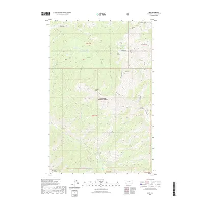
1968 Brief
Chelan County, WA

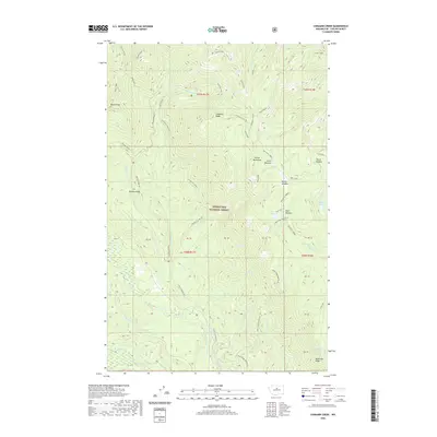
1968 Chikamin Creek
Chelan County, WA

1968 Chumstick Mtn
Chelan County, WA

1968 Cooper Ridge
Chelan County, WA

1968 Oss Peak
Chelan County, WA

1968 Plain
Chelan County, WA

1968 Rocky Reach Dam
Chelan County, WA

1968 Silver Falls
Chelan County, WA

1968 South Navarre Peak
Chelan County, WA

1968 Stormy Mtn.
Chelan County, WA

1968 Sugarloaf Peak
Chelan County, WA

1968 Tyee Mtn.
Chelan County, WA

1968 Winesap
Chelan County, WA

1969 Mc Alester Mtn
Chelan County, WA

1969 Prince Creek
Chelan County, WA

1969 Stehekin
Chelan County, WA

1969 Sun Mountain
Chelan County, WA

1988 Clark Mountain
Chelan County, WA
1988 Holden
Chelan County, WA

1988 Lucerne
Chelan County, WA

1988 Pinnacle Mountain
Chelan County, WA

1988 Pyramid Mountain
Chelan County, WA

1988 Saska Peak
Chelan County, WA

1988 Suiattle Pass
Chelan County, WA

1988 Trinity
Chelan County, WA

1989 Big Jim Mountain
Chelan County, WA

1989 Blewett
Chelan County, WA

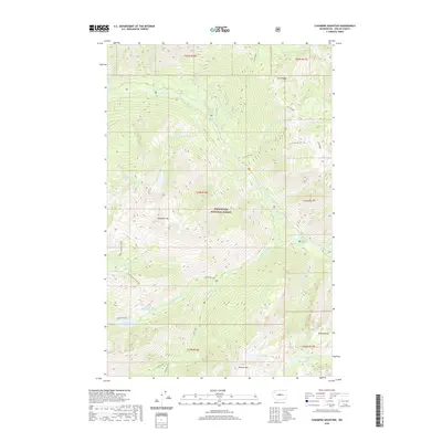
1989 Cashmere Mountain
Chelan County, WA

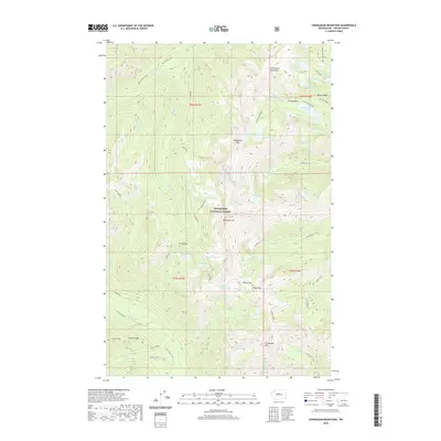
1989 Chiwaukum Mountains
Chelan County, WA

1989 Enchantment Lakes
Chelan County, WA

1989 Jack Ridge
Chelan County, WA

1989 Lake Wenatchee
Chelan County, WA

1989 Mount David
Chelan County, WA

1989 Mount Howard
Chelan County, WA

1989 Peshastin
Chelan County, WA

1989 Schaffer Lake
Chelan County, WA

1989 Tiptop
Chelan County, WA

1989 Van Creek
Chelan County, WA

1989 Winton
Chelan County, WA

1999 Suiattle Pass
Chelan County, WA

2001 Azwell
Chelan County, WA

2002 McAlester Mountain
Chelan County, WA

2002 Sun Mountain
Chelan County, WA

2003 Ardenvoir
Chelan County, WA

2003 Blewett
Chelan County, WA

2003 Cashmere Mountain
Chelan County, WA

2003 Chumstick Mountain
Chelan County, WA

2003 Enchantment Lakes
Chelan County, WA

2003 Jack Ridge
Chelan County, WA

2003 Mission Peak
Chelan County, WA

2003 Monitor
Chelan County, WA

2003 Peshastin
Chelan County, WA

2003 Rocky Reach Dam
Chelan County, WA

2003 The Cradle
Chelan County, WA

2003 Tiptop
Chelan County, WA

2003 Van Creek
Chelan County, WA

2003 Wenatchee Heights
Chelan County, WA

2003 Winton
Chelan County, WA

2004 Baldy Mountain
Chelan County, WA

2004 Brief
Chelan County, WA

2004 Chikamin Creek
Chelan County, WA

2004 Chiwaukum Mountains
Chelan County, WA

2004 Clark Mountain
Chelan County, WA

2004 Cooper Ridge
Chelan County, WA

2004 Goode Mountain
Chelan County, WA

2004 Holden
Chelan County, WA

2004 Lake Wenatchee
Chelan County, WA

2004 Lucerne
Chelan County, WA

2004 McGregor Mountain
Chelan County, WA

2004 Mount David
Chelan County, WA

2004 Mount Howard
Chelan County, WA

2004 Mount Lyall
Chelan County, WA

2004 Oss Peak
Chelan County, WA

2004 Pinnacle Mountain
Chelan County, WA

2004 Plain
Chelan County, WA

2004 Poe Mountain
Chelan County, WA

2004 Prince Creek
Chelan County, WA

2004 Pyramid Mountain
Chelan County, WA

2004 Saska Peak
Chelan County, WA

2004 Schaffer Lake
Chelan County, WA

2004 Silver Falls
Chelan County, WA

2004 South Navarre Peak
Chelan County, WA

2004 Stormy Mountain
Chelan County, WA

2004 Sugarloaf Peak
Chelan County, WA

2004 Tyee Mountain
Chelan County, WA

2004 Winesap
Chelan County, WA

2005 Big Jim Mountain
Chelan County, WA
2011 Agnes Mountain
Chelan County, WA
2011 Ardenvoir
Chelan County, WA
2011 Azwell
Chelan County, WA
2011 Baldy Mountain
Chelan County, WA
2011 Big Goat Mountain
Chelan County, WA
2011 Big Jim Mountain
Chelan County, WA
2011 Blewett
Chelan County, WA
2011 Brief
Chelan County, WA
2011 Cashmere Mountain
Chelan County, WA
2011 Chikamin Creek
Chelan County, WA
2011 Chiwaukum Mountains
Chelan County, WA
2011 Chumstick Mountain
Chelan County, WA
2011 Clark Mountain
Chelan County, WA
2011 Cooper Ridge
Chelan County, WA
2011 Enchantment Lakes
Chelan County, WA
2011 Goode Mountain
Chelan County, WA
2011 Holden
Chelan County, WA
2011 Jack Ridge
Chelan County, WA
2011 Labyrinth Mountain
Chelan County, WA
2011 Lake Wenatchee
Chelan County, WA
2011 Lucerne
Chelan County, WA
2011 Malaga
Chelan County, WA
2011 McAlester Mountain
Chelan County, WA
2011 McGregor Mountain
Chelan County, WA
2011 Mission Peak
Chelan County, WA
2011 Monitor
Chelan County, WA
2011 Mount David
Chelan County, WA
2011 Mount Howard
Chelan County, WA
2011 Mount Lyall
Chelan County, WA
2011 Oss Peak
Chelan County, WA
2011 Peshastin
Chelan County, WA
2011 Pinnacle Mountain
Chelan County, WA
2011 Plain
Chelan County, WA
2011 Poe Mountain
Chelan County, WA
2011 Prince Creek
Chelan County, WA
2011 Pyramid Mountain
Chelan County, WA
2011 Rocky Reach Dam
Chelan County, WA
2011 Saska Peak
Chelan County, WA
2011 Schaefer Lake
Chelan County, WA
2011 Silver Falls
Chelan County, WA
2011 South Navarre Peak
Chelan County, WA
2011 Stehekin
Chelan County, WA
2011 Stevens Pass
Chelan County, WA
2011 Stormy Mountain
Chelan County, WA
2011 Sugarloaf Peak
Chelan County, WA
2011 Suiattle Pass
Chelan County, WA
2011 Sun Mountain
Chelan County, WA
2011 The Cradle
Chelan County, WA
2011 Tiptop
Chelan County, WA
2011 Trinity
Chelan County, WA
2011 Tyee Mountain
Chelan County, WA
2011 Van Creek
Chelan County, WA
2011 Wenatchee Heights
Chelan County, WA
2011 Winesap
Chelan County, WA
2011 Winton
Chelan County, WA
2014 Agnes Mountain
Chelan County, WA
2014 Ardenvoir
Chelan County, WA
2014 Azwell
Chelan County, WA
2014 Baldy Mountain
Chelan County, WA
2014 Big Goat Mountain
Chelan County, WA
2014 Big Jim Mountain
Chelan County, WA
2014 Blewett
Chelan County, WA
2014 Brief
Chelan County, WA
2014 Cashmere Mountain
Chelan County, WA
2014 Chikamin Creek
Chelan County, WA
2014 Chiwaukum Mountains
Chelan County, WA
2014 Chumstick Mountain
Chelan County, WA
2014 Clark Mountain
Chelan County, WA
2014 Cooper Ridge
Chelan County, WA
2014 Enchantment Lakes
Chelan County, WA
2014 Goode Mountain
Chelan County, WA
2014 Holden
Chelan County, WA
2014 Jack Ridge
Chelan County, WA
2014 Labyrinth Mountain
Chelan County, WA
2014 Lake Wenatchee
Chelan County, WA
2014 Lucerne
Chelan County, WA
2014 Malaga
Chelan County, WA
2014 McAlester Mountain
Chelan County, WA
2014 McGregor Mountain
Chelan County, WA
2014 Mission Peak
Chelan County, WA
2014 Monitor
Chelan County, WA
2014 Mount David
Chelan County, WA
2014 Mount Howard
Chelan County, WA
2014 Mount Lyall
Chelan County, WA
2014 Oss Peak
Chelan County, WA
2014 Peshastin
Chelan County, WA
2014 Pinnacle Mountain
Chelan County, WA
2014 Plain
Chelan County, WA
2014 Poe Mountain
Chelan County, WA
2014 Prince Creek
Chelan County, WA
2014 Pyramid Mountain
Chelan County, WA
2014 Rocky Reach Dam
Chelan County, WA
2014 Saska Peak
Chelan County, WA
2014 Schaefer Lake
Chelan County, WA
2014 Silver Falls
Chelan County, WA
2014 South Navarre Peak
Chelan County, WA
2014 Stehekin
Chelan County, WA
2014 Stevens Pass
Chelan County, WA
2014 Stormy Mountain
Chelan County, WA
2014 Sugarloaf Peak
Chelan County, WA
2014 Suiattle Pass
Chelan County, WA
2014 Sun Mountain
Chelan County, WA
2014 The Cradle
Chelan County, WA
2014 Tiptop
Chelan County, WA
2014 Trinity
Chelan County, WA
2014 Tyee Mountain
Chelan County, WA
2014 Van Creek
Chelan County, WA
2014 Wenatchee Heights
Chelan County, WA
2014 Winesap
Chelan County, WA
2014 Winton
Chelan County, WA
2017 Agnes Mountain
Chelan County, WA
2017 Ardenvoir
Chelan County, WA
2017 Azwell
Chelan County, WA
2017 Baldy Mountain
Chelan County, WA
2017 Big Goat Mountain
Chelan County, WA
2017 Big Jim Mountain
Chelan County, WA
2017 Blewett
Chelan County, WA
2017 Brief
Chelan County, WA
2017 Cashmere Mountain
Chelan County, WA
2017 Chikamin Creek
Chelan County, WA

2017 Chiwaukum Mountains
Chelan County, WA
2017 Chumstick Mountain
Chelan County, WA
2017 Clark Mountain
Chelan County, WA
2017 Cooper Ridge
Chelan County, WA
2017 Enchantment Lakes
Chelan County, WA
2017 Goode Mountain
Chelan County, WA
2017 Holden
Chelan County, WA
2017 Jack Ridge
Chelan County, WA
2017 Labyrinth Mountain
Chelan County, WA
2017 Lake Wenatchee
Chelan County, WA
2017 Lucerne
Chelan County, WA
2017 Malaga
Chelan County, WA
2017 McAlester Mountain
Chelan County, WA
2017 McGregor Mountain
Chelan County, WA
2017 Mission Peak
Chelan County, WA
2017 Monitor
Chelan County, WA
2017 Mount David
Chelan County, WA
2017 Mount Howard
Chelan County, WA
2017 Mount Lyall
Chelan County, WA
2017 Oss Peak
Chelan County, WA
2017 Peshastin
Chelan County, WA
2017 Pinnacle Mountain
Chelan County, WA
2017 Plain
Chelan County, WA
2017 Poe Mountain
Chelan County, WA
2017 Prince Creek
Chelan County, WA
2017 Pyramid Mountain
Chelan County, WA
2017 Rocky Reach Dam
Chelan County, WA
2017 Saska Peak
Chelan County, WA
2017 Schaefer Lake
Chelan County, WA
2017 Silver Falls
Chelan County, WA
2017 South Navarre Peak
Chelan County, WA
2017 Stehekin
Chelan County, WA
2017 Stevens Pass
Chelan County, WA
2017 Stormy Mountain
Chelan County, WA
2017 Sugarloaf Peak
Chelan County, WA
2017 Suiattle Pass
Chelan County, WA
2017 Sun Mountain
Chelan County, WA
2017 The Cradle
Chelan County, WA
2017 Tiptop
Chelan County, WA
2017 Trinity
Chelan County, WA
2017 Tyee Mountain
Chelan County, WA
2017 Van Creek
Chelan County, WA
2017 Wenatchee Heights
Chelan County, WA
2017 Winesap
Chelan County, WA
2017 Winton
Chelan County, WA
2020 Agnes Mountain
Chelan County, WA
2020 Ardenvoir
Chelan County, WA
2020 Azwell
Chelan County, WA
2020 Baldy Mountain
Chelan County, WA
2020 Big Goat Mountain
Chelan County, WA
2020 Big Jim Mountain
Chelan County, WA
2020 Blewett
Chelan County, WA
2020 Brief
Chelan County, WA
2020 Cashmere Mountain
Chelan County, WA
2020 Chikamin Creek
Chelan County, WA
2020 Chiwaukum Mountains
Chelan County, WA
2020 Chumstick Mountain
Chelan County, WA
2020 Clark Mountain
Chelan County, WA
2020 Cooper Ridge
Chelan County, WA
2020 Enchantment Lakes
Chelan County, WA
2020 Goode Mountain
Chelan County, WA
2020 Holden
Chelan County, WA
2020 Jack Ridge
Chelan County, WA
2020 Labyrinth Mountain
Chelan County, WA
2020 Lake Wenatchee
Chelan County, WA
2020 Lucerne
Chelan County, WA
2020 Malaga
Chelan County, WA
2020 McAlester Mountain
Chelan County, WA
2020 McGregor Mountain
Chelan County, WA
2020 Mission Peak
Chelan County, WA
2020 Monitor
Chelan County, WA
2020 Mount David
Chelan County, WA
2020 Mount Howard
Chelan County, WA
2020 Mount Lyall
Chelan County, WA
2020 Oss Peak
Chelan County, WA
2020 Peshastin
Chelan County, WA
2020 Pinnacle Mountain
Chelan County, WA
2020 Plain
Chelan County, WA
2020 Poe Mountain
Chelan County, WA
2020 Prince Creek
Chelan County, WA
2020 Pyramid Mountain
Chelan County, WA
2020 Rocky Reach Dam
Chelan County, WA
2020 Saska Peak
Chelan County, WA
2020 Schaefer Lake
Chelan County, WA
2020 Silver Falls
Chelan County, WA
2020 South Navarre Peak
Chelan County, WA
2020 Stehekin
Chelan County, WA
2020 Stevens Pass
Chelan County, WA
2020 Stormy Mountain
Chelan County, WA
2020 Sugarloaf Peak
Chelan County, WA
2020 Suiattle Pass
Chelan County, WA
2020 Sun Mountain
Chelan County, WA
2020 The Cradle
Chelan County, WA
2020 Tiptop
Chelan County, WA
2020 Trinity
Chelan County, WA
2020 Tyee Mountain
Chelan County, WA
2020 Van Creek
Chelan County, WA
2020 Wenatchee Heights
Chelan County, WA
2020 Winesap
Chelan County, WA
2020 Winton
Chelan County, WA

2023 Agnes Mountain
Chelan County, WA

2023 Ardenvoir
Chelan County, WA

2023 Azwell
Chelan County, WA

2023 Baldy Mountain
Chelan County, WA

2023 Big Goat Mountain
Chelan County, WA

2023 Big Jim Mountain
Chelan County, WA

2023 Blewett
Chelan County, WA

2023 Brief
Chelan County, WA

2023 Cashmere Mountain
Chelan County, WA

2023 Chikamin Creek
Chelan County, WA

2023 Chiwaukum Mountains
Chelan County, WA

2023 Chumstick Mountain
Chelan County, WA

2023 Clark Mountain
Chelan County, WA

2023 Cooper Ridge
Chelan County, WA

2023 Enchantment Lakes
Chelan County, WA

2023 Goode Mountain
Chelan County, WA

2023 Holden
Chelan County, WA

2023 Jack Ridge
Chelan County, WA

2023 Labyrinth Mountain
Chelan County, WA

2023 Lake Wenatchee
Chelan County, WA

2023 Lucerne
Chelan County, WA

2023 Malaga
Chelan County, WA

2023 McAlester Mountain
Chelan County, WA

2023 McGregor Mountain
Chelan County, WA

2023 Mission Peak
Chelan County, WA

2023 Monitor
Chelan County, WA

2023 Mount David
Chelan County, WA

2023 Mount Howard
Chelan County, WA

2023 Mount Lyall
Chelan County, WA

2023 Oss Peak
Chelan County, WA

2023 Peshastin
Chelan County, WA

2023 Pinnacle Mountain
Chelan County, WA

2023 Plain
Chelan County, WA

2023 Poe Mountain
Chelan County, WA

2023 Prince Creek
Chelan County, WA

2023 Pyramid Mountain
Chelan County, WA

2023 Rocky Reach Dam
Chelan County, WA

2023 Saska Peak
Chelan County, WA

2023 Schaefer Lake
Chelan County, WA

2023 Silver Falls
Chelan County, WA

2023 South Navarre Peak
Chelan County, WA

2023 Stehekin
Chelan County, WA

2023 Stevens Pass
Chelan County, WA

2023 Stormy Mountain
Chelan County, WA

2023 Sugarloaf Peak
Chelan County, WA

2023 Suiattle Pass
Chelan County, WA

2023 Sun Mountain
Chelan County, WA

2023 The Cradle
Chelan County, WA

2023 Tiptop
Chelan County, WA

2023 Trinity
Chelan County, WA

2023 Tyee Mountain
Chelan County, WA

2023 Van Creek
Chelan County, WA

2023 Wenatchee Heights
Chelan County, WA

2023 Winesap
Chelan County, WA

2023 Winton
Chelan County, WA