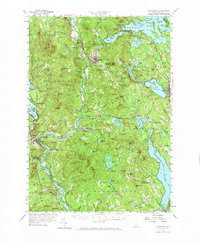
1956 Map of Holderness
USGS Topo · Published 1971About this map
Squam Lake and the winding Pemigewasset River define this mid-century landscape in the Lakes Region, where water-powered industry and early tourism intersect. The Boston and Maine Railroad and the Daniel Webster Highway provide the primary north-south corridors, linking the established centers of Ashland and Meredith with smaller rural hamlets. The map documents a dense network of local landmarks, from the Bay Meetinghouse in the south to the Fish Hatchery near New Hampton.
Find a feature on this map
121 named features on this map. Tap any name to fly to it.
Don’t see what you’re looking for? This feature index may not catch every label — zoom into the map to look around manually.
Map Details
Editions of this 1956 Holderness Map
3 editions found

Other maps of this area

1909 · Winnepesaukee
USGS Topo · 1:62,500

1919 · Gilmanton
USGS Topo · 1:62,500

1925 · Holderness
USGS Topo · 1:62,500

1927 · Penacook
USGS Topo · 1:62,500

1927 · Gilmanton
USGS Topo · 1:62,500

1927 · Holderness
USGS Topo · 1:62,500

1927 · Cardigan
USGS Topo · 1:62,500

1928 · Mount Kearsarge
USGS Topo · 1:62,500

1928 · Plymouth
USGS Topo · 1:62,500

1928 · Rumney
USGS Topo · 1:62,500