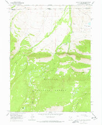
1967 Map of Hole In The Rock
USGS Topo · Published 1967About this map
The Wasatch National Forest straddles the high-altitude border of Utah and Wyoming, where the drainage of Beaver Creek carves through the Bald Range. This 1967 survey documents a high-country landscape defined by resource management and recreation, anchored by the Hole in the Rock Guard Station and nearby Hole in the Rock Gaging Station. To the east, Coal Mine Hill indicates historical mineral interest, while the presence of a Coal Mine and a Drill Hole in Gregory Basin suggest early extractive exploration in this remote terrain.
Find a feature on this map
31 named features on this map. Tap any name to fly to it.
Don’t see what you’re looking for? This feature index may not catch every label — zoom into the map to look around manually.
Map Details
Editions of this 1967 Hole In The Rock Map
2 editions found
Other maps of this area

1885 · Uinta
USGS Topo · 1:250,000

1905 · Gilbert Peak
USGS Topo · 1:125,000

1906 · Gilbert Peak
USGS Topo · 1:125,000

1954 · Salt Lake City
USGS Topo · 1:250,000

1954 · Ogden
USGS Topo · 1:250,000

1958 · Ogden
USGS Topo · 1:250,000

1958 · Salt Lake City
USGS Topo · 1:250,000

1960 · Ogden
USGS Topo · 1:250,000

1960 · Salt Lake City
USGS Topo · 1:250,000
1964 · Lonetree
USGS Topo · 1:24,000