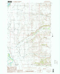
1986 Map of Holker
USGS Topo · Published 1986About this map
The Missouri River corridor in Broadwater County is defined by a complex network of irrigation and aviation infrastructure in the mid-1980s. The landscape transitions from the southern reaches of Canyon Ferry Lake to an agricultural plain sustained by the Broadwater Canal and Montana Ditch. Central to this area is the Townsend Airport, positioned near the Rodeo Ground and a local Golf Course, reflecting the civic and recreational priorities of the era.
Find a feature on this map
20 named features on this map. Tap any name to fly to it.
Don’t see what you’re looking for? This feature index may not catch every label — zoom into the map to look around manually.
Map Details
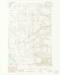
Editions of this 1986 Holker Map
2 editions found
Other maps of this area

1886 · Fort Logan
USGS Topo · 1:250,000

1948 · White Sulphur Springs
USGS Topo · 1:250,000

1949 · Radersburg
USGS Topo · 1:62,500

1949 · Toston
USGS Topo · 1:62,500

1950 · Townsend
USGS Topo · 1:62,500

1950 · Duck Creek Pass
USGS Topo · 1:62,500

1958 · White Sulphur Springs
USGS Topo · 1:250,000

1961 · White Sulphur Springs
USGS Topo · 1:250,000

1965 · White Sulphur Springs
USGS Topo · 1:250,000

1976 · Townsend
USGS Topo · 1:100,000